Daulatpur geodata
Daulatpur (Himachal Pradesh) is a populated place; located in India in Asia/Kolkata (GMT+5.5) time zone. With population of 4,810 people, there are 3350 cities with bigger population in this country. Compared to other cities in India, 97.5% of cities are located further ↓South; 73.7% of cities are located further →East and 84.4% of cities have lower elevation than Daulatpur. Note1


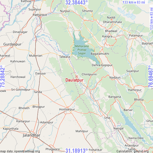
Daulatpur GPS coordinates[2]
31° 47' 19.356" North, 75° 59' 29.544" East
| Map corner | latitude | longitude |
|---|---|---|
| Upper-left | 32.38443°, | 75.28842° |
| Center: | 31.78871°, | 75.99154° |
| Lower-right: | 31.18913°, | 76.69467° |
| Map W x H: | 132.9×132.9 km | = 82.6×82.6mi |
| max Lat: | 34.9274° ⇑2.5% North |
| Daulatpur: | 31.78871° |
| min Lat: | ⇓97.5% South 8.09008° |
| min Long | Daulatpur | max Long |
| 68.82655° | 75.99154° | 96.81° |
| W 26.3%⇐ | ⇒73.7% E |
Elevation
Elevation of Daulatpur is 540 m = 1772 ft, and this is 244.4 m = 802 ft above average elevation for this country.
| Max E: |
3681 m = 12077 ft | 15.6% |
| Daulatpur | 540 m 1772 ft | |
| Avg. | 295.6 m = 970 ft | |
Min E: |
1 m = 3 ft | 84.4% |
See also: India elevation on elevation.city.
Geographical zone
Daulatpur is located in North temperate zone (between Tropic of Cancer and the Arctic Circle). Distance of this Northern Tropic circle is 928.7 km =577.1 mi to South.| Distance of | km | miles | from Daulatpur |
|---|---|---|---|
| North Pole | 6472.5 | 4021.8 | to North |
| Arctic Circle | 3866.6 | 2402.6 | to North |
| Tropic Cancer | 928.7 | 577.1 | to South |
| Equator | 3534.6 | 2196.3 | to South |


Nearby cities:
15 places around Daulatpur: (largest is in red/bold)
• Bhogpur
42.1 km =26.2 mi,  231°
231°
• Dasūya
32.1 km =19.9 mi,  275°
275°
• Daulatpur
39.1 km =24.3 mi,  40°
40°
• Dera Gopipur
23.7 km =14.7 mi,  64°
64°
• Gagret
15.9 km =9.9 mi,  155°
155°
• Garhdiwāla
22.9 km =14.2 mi,  256°
256°
• Hariāna
22.4 km =13.9 mi,  220°
220°
• Hoshiārpur
28.9 km =18 mi,  194°
194°
• Hājipur
30.7 km =19.1 mi,  313°
313°
• Jawāla Mukhi
32.5 km =20.2 mi,  72°
72°
• Mukeriān
39.8 km =24.7 mi,  297°
297°
• Nagrota
31.3 km =19.4 mi,  17°
17°
• Nādaun
33.2 km =20.6 mi,  91°
91°
• Shām Churāsi
39.4 km =24.5 mi, 215°
• Talwāra
19.3 km =12 mi,  329°
329°
Sources, notices
• [Note1] Compared only with cities in India existing in our database
• [Src1] Map data: © OpenStreetMap contributors (CC-BY-SA)
• [Src2] Other city data from geonames.org with taken over terms of usage.
• [Src3] Geographical zone / Annual Mean Temperature by Robert A. Rohde @ Wikipedia
