Nagrota geodata
Nagrota (Himachal Pradesh) is a populated place; located in India in Asia/Kolkata (GMT+5.5) time zone. With population of 6,125 people, there are 3277 cities with bigger population in this country. Compared to other cities in India, 98% of cities are located further ↓South; 72.6% of cities are located further →East and 79.9% of cities have lower elevation than Nagrota. Note1


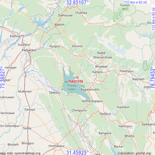
Nagrota GPS coordinates[2]
32° 3' 25.56" North, 76° 5' 29.004" East
| Map corner | latitude | longitude |
|---|---|---|
| Upper-left | 32.65107°, | 75.38827° |
| Center: | 32.0571°, | 76.09139° |
| Lower-right: | 31.45925°, | 76.79452° |
| Map W x H: | 132.5×132.5 km | = 82.3×82.3mi |
| max Lat: | 34.9274° ⇑2% North |
| Nagrota: | 32.0571° |
| min Lat: | ⇓98% South 8.09008° |
| min Long | Nagrota | max Long |
| 68.82655° | 76.09139° | 96.81° |
| W 27.4%⇐ | ⇒72.6% E |
Elevation
Elevation of Nagrota is 457 m = 1499 ft, and this is 161.4 m = 530 ft above average elevation for this country.
| Max E: |
3681 m = 12077 ft | 20.1% |
| Nagrota | 457 m 1499 ft | |
| Avg. | 295.6 m = 970 ft | |
Min E: |
1 m = 3 ft | 79.9% |
See also: India elevation on elevation.city.
Geographical zone
Nagrota is located in North temperate zone (between Tropic of Cancer and the Arctic Circle). Distance of this Northern Tropic circle is 958.5 km =595.6 mi to South.| Distance of | km | miles | from Nagrota |
|---|---|---|---|
| North Pole | 6442.6 | 4003.2 | to North |
| Arctic Circle | 3836.8 | 2384.1 | to North |
| Tropic Cancer | 958.5 | 595.6 | to South |
| Equator | 3564.4 | 2214.8 | to South |


Nearby cities:
15 places around Nagrota: (largest is in red/bold)
• Chowari
42.3 km =26.3 mi,  349°
349°
• Chuāri Khās
42.2 km =26.2 mi, 350°
• Daulatpur
16 km =9.9 mi,  90°
90°
• Daulatpur
31.3 km =19.4 mi,  197°
197°
• Dera Gopipur
23.1 km =14.4 mi,  148°
148°
• Dharamsala
28.1 km =17.5 mi,  49°
49°
• Gagret
44.4 km =27.6 mi,  183°
183°
• Hājipur
33 km =20.5 mi,  254°
254°
• Jawāla Mukhi
29.6 km =18.4 mi,  133°
133°
• Kotla
22.1 km =13.7 mi, 345°
• Kāngar
16.6 km =10.3 mi,  76°
76°
• Nādaun
38.6 km =24 mi,  142°
142°
• Pālampur
44.3 km =27.5 mi, 81°
• Talwāra
23.4 km =14.5 mi,  235°
235°
• Yol
15.5 km =9.6 mi,  39°
39°
Sources, notices
• [Note1] Compared only with cities in India existing in our database
• [Src1] Map data: © OpenStreetMap contributors (CC-BY-SA)
• [Src2] Other city data from geonames.org with taken over terms of usage.
• [Src3] Geographical zone / Annual Mean Temperature by Robert A. Rohde @ Wikipedia
