Yol geodata
Yol (Himachal Pradesh) is a populated place; located in India in Asia/Kolkata (GMT+5.5) time zone. With population of 11,314 people, there are 2802 cities with bigger population in this country. Compared to other cities in India, 98.2% of cities are located further ↓South; 71.7% of cities are located further →East and 91.6% of cities have lower elevation than Yol. Note1


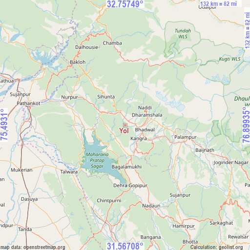
Yol GPS coordinates[2]
32° 9' 51.228" North, 76° 11' 46.392" East
| Map corner | latitude | longitude |
|---|---|---|
| Upper-left | 32.75749°, | 75.4931° |
| Center: | 32.16423°, | 76.19622° |
| Lower-right: | 31.56708°, | 76.89935° |
| Map W x H: | 132.4×132.4 km | = 82.3×82.3mi |
| max Lat: | 34.9274° ⇑1.8% North |
| Yol: | 32.16423° |
| min Lat: | ⇓98.2% South 8.09008° |
| min Long | Yol | max Long |
| 68.82655° | 76.19622° | 96.81° |
| W 28.3%⇐ | ⇒71.7% E |
Elevation
Elevation of Yol is 672 m = 2205 ft, and this is 376.4 m = 1235 ft above average elevation for this country.
| Max E: |
3681 m = 12077 ft | 8.4% |
| Yol | 672 m 2205 ft | |
| Avg. | 295.6 m = 970 ft | |
Min E: |
1 m = 3 ft | 91.6% |
See also: India elevation on elevation.city.
Geographical zone
Yol is located in North temperate zone (between Tropic of Cancer and the Arctic Circle). Distance of this Northern Tropic circle is 970.4 km =603 mi to South.| Distance of | km | miles | from Yol |
|---|---|---|---|
| North Pole | 6430.7 | 3995.9 | to North |
| Arctic Circle | 3824.8 | 2376.6 | to North |
| Tropic Cancer | 970.4 | 603 | to South |
| Equator | 3576.3 | 2222.2 | to South |


Nearby cities:
15 places around Yol: (largest is in red/bold)
• Bakloh
43.7 km =27.2 mi,  323°
323°
• Chamba
44 km =27.3 mi,  351°
351°
• Chowari
34.4 km =21.4 mi,  329°
329°
• Chuāri Khās
34.2 km =21.3 mi, 329°
• Daulatpur
13.5 km =8.4 mi,  153°
153°
• Daulatpur
46 km =28.6 mi,  204°
204°
• Dera Gopipur
31.8 km =19.8 mi,  176°
176°
• Dharamsala
13.2 km =8.2 mi,  61°
61°
• Jawāla Mukhi
34.3 km =21.3 mi,  160°
160°
• Kotla
18 km =11.2 mi,  301°
301°
• Kāngar
10.2 km =6.3 mi,  142°
142°
• Nagrota
15.5 km =9.6 mi,  219°
219°
• Nādaun
44.6 km =27.7 mi, 161°
• Pālampur
34.4 km =21.4 mi,  99°
99°
• Talwāra
38.6 km =24 mi,  229°
229°
Sources, notices
• [Note1] Compared only with cities in India existing in our database
• [Src1] Map data: © OpenStreetMap contributors (CC-BY-SA)
• [Src2] Other city data from geonames.org with taken over terms of usage.
• [Src3] Geographical zone / Annual Mean Temperature by Robert A. Rohde @ Wikipedia
