Bhagwantnagar geodata
Bhagwantnagar (Uttar Pradesh) is a populated place; located in India in Asia/Kolkata (GMT+5.5) time zone. With population of 6,596 people, there are 3243 cities with bigger population in this country. Compared to other cities in India, 72.1% of cities are located further ↓South; 72% of cities are located further ←West and 64% of cities have higher elevation than Bhagwantnagar. Note1


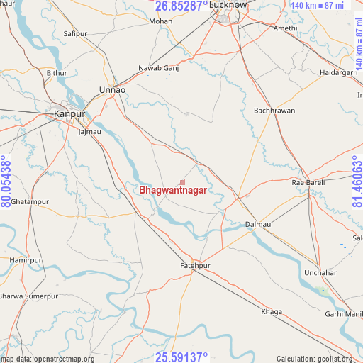
Bhagwantnagar GPS coordinates[2]
26° 13' 25.788" North, 80° 45' 27" East
| Map corner | latitude | longitude |
|---|---|---|
| Upper-left | 26.85287°, | 80.05438° |
| Center: | 26.22383°, | 80.7575° |
| Lower-right: | 25.59137°, | 81.46063° |
| Map W x H: | 140.3×140.3 km | = 87.2×87.2mi |
| max Lat: | 34.9274° ⇑27.9% North |
| Bhagwantnagar: | 26.22383° |
| min Lat: | ⇓72.1% South 8.09008° |
| min Long | Bhagwantnagar | max Long |
| 68.82655° | 80.7575° | 96.81° |
| W 72%⇐ | ⇒28% E |
Elevation
Elevation of Bhagwantnagar is 127 m = 417 ft, and this is 168.6 m = 553 ft below average elevation for this country.
| Max E: |
3681 m = 12077 ft | 64% |
| Avg. | 295.6 m = 970 ft | |
| Bhagwantnagar | 127 m = 417 ft | |
Min E: |
1 m = 3 ft | 36% |
See also: India elevation on elevation.city.
Geographical zone
Bhagwantnagar is located in North temperate zone (between Tropic of Cancer and the Arctic Circle). Distance of this Northern Tropic circle is 309.9 km =192.6 mi to South.| Distance of | km | miles | from Bhagwantnagar |
|---|---|---|---|
| North Pole | 7091.2 | 4406.3 | to North |
| Arctic Circle | 4485.4 | 2787.1 | to North |
| Tropic Cancer | 309.9 | 192.6 | to South |
| Equator | 2915.8 | 1811.8 | to South |


Nearby cities:
15 places around Bhagwantnagar: (largest is in red/bold)
• Bachhrāwān
45 km =28 mi,  52°
52°
• Bahua
44.8 km =27.8 mi,  197°
197°
• Bindki
27.6 km =17.1 mi,  220°
220°
• Bīghāpur Khurd
17 km =10.6 mi,  323°
323°
• Dalmau
32.4 km =20.1 mi,  123°
123°
• Fatehpur
33.4 km =20.8 mi,  170°
170°
• Ghātampur
59.3 km =36.8 mi,  262°
262°
• Kanpur
48.7 km =30.3 mi,  303°
303°
• Mahārājganj
54.4 km =33.8 mi,  71°
71°
• Maurānwān
25.9 km =16.1 mi,  28°
28°
• Nagrām
58.2 km =36.2 mi,  40°
40°
• Nawābganj
54 km =33.6 mi, 304°
• Purwā
26 km =16.2 mi,  3°
3°
• Raebareli
47.4 km =29.5 mi,  89°
89°
• Unnāo
44.9 km =27.9 mi, 323°
Sources, notices
• [Note1] Compared only with cities in India existing in our database
• [Src1] Map data: © OpenStreetMap contributors (CC-BY-SA)
• [Src2] Other city data from geonames.org with taken over terms of usage.
• [Src3] Geographical zone / Annual Mean Temperature by Robert A. Rohde @ Wikipedia
