Fatehpur geodata
Fatehpur (Uttar Pradesh) is a populated place; located in India in Asia/Kolkata (GMT+5.5) time zone. With population of 166,480 people, there are 257 cities with bigger population in this country. Compared to other cities in India, 69.9% of cities are located further ↓South; 72.3% of cities are located further ←West and 64.8% of cities have higher elevation than Fatehpur. Note1


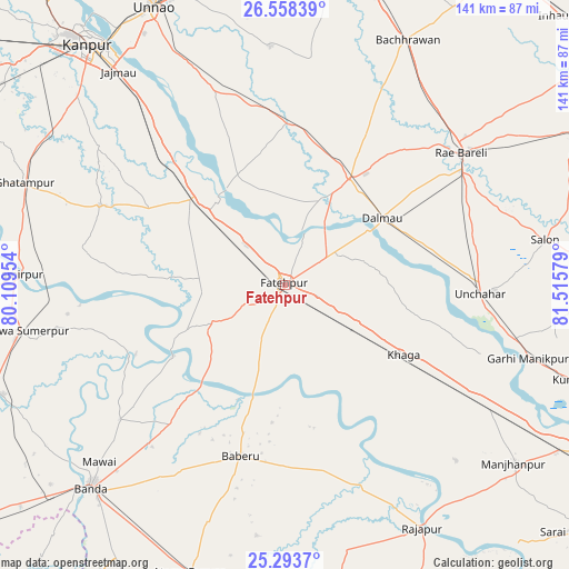
Fatehpur GPS coordinates[2]
25° 55' 39.864" North, 80° 48' 45.576" East
| Map corner | latitude | longitude |
|---|---|---|
| Upper-left | 26.55839°, | 80.10954° |
| Center: | 25.92774°, | 80.81266° |
| Lower-right: | 25.2937°, | 81.51579° |
| Map W x H: | 140.6×140.6 km | = 87.4×87.4mi |
| max Lat: | 34.9274° ⇑30.1% North |
| Fatehpur: | 25.92774° |
| min Lat: | ⇓69.9% South 8.09008° |
| min Long | Fatehpur | max Long |
| 68.82655° | 80.81266° | 96.81° |
| W 72.3%⇐ | ⇒27.7% E |
Elevation
Elevation of Fatehpur is 121 m = 397 ft, and this is 174.6 m = 573 ft below average elevation for this country.
| Max E: |
3681 m = 12077 ft | 64.8% |
| Avg. | 295.6 m = 970 ft | |
| Fatehpur | 121 m = 397 ft | |
Min E: |
1 m = 3 ft | 35.2% |
See also: Fatehpur elevation on elevation.city.
Geographical zone
Fatehpur is located in North temperate zone (between Tropic of Cancer and the Arctic Circle). Distance of this Northern Tropic circle is 277 km =172.1 mi to South.| Distance of | km | miles | from Fatehpur |
|---|---|---|---|
| North Pole | 7124.2 | 4426.8 | to North |
| Arctic Circle | 4518.3 | 2807.5 | to North |
| Tropic Cancer | 277 | 172.1 | to South |
| Equator | 2882.9 | 1791.4 | to South |


Nearby cities:
15 places around Fatehpur: (largest is in red/bold)
• Baberu
43.7 km =27.2 mi,  194°
194°
• Bahua
21.4 km =13.3 mi,  242°
242°
• Bhagwantnagar
33.4 km =20.8 mi,  350°
350°
• Bindki
26.5 km =16.5 mi,  297°
297°
• Bisenda Buzurg
61.4 km =38.2 mi,  198°
198°
• Bīghāpur Khurd
49.2 km =30.6 mi,  341°
341°
• Dalmau
26.5 km =16.5 mi,  54°
54°
• Khāga
33.9 km =21.1 mi,  120°
120°
• Kishanpur
38.1 km =23.7 mi,  146°
146°
• Maurānwān
56.1 km =34.9 mi,  6°
6°
• Oran
62.5 km =38.8 mi, 186°
• Purwā
59 km =36.7 mi,  356°
356°
• Raebareli
53.8 km =33.4 mi, 51°
• Sirāthu
59.7 km =37.1 mi, 122°
• Tindwāri
44.8 km =27.8 mi,  219°
219°
Sources, notices
• [Note1] Compared only with cities in India existing in our database
• [Src1] Map data: © OpenStreetMap contributors (CC-BY-SA)
• [Src2] Other city data from geonames.org with taken over terms of usage.
• [Src3] Geographical zone / Annual Mean Temperature by Robert A. Rohde @ Wikipedia
