Jāmai geodata
Jāmai (Madhya Pradesh) is a populated place; located in India in Asia/Kolkata (GMT+5.5) time zone. With population of 22,587 people, there are 1870 cities with bigger population in this country. Compared to other cities in India, 55.2% of cities are located further ↑North; 55.1% of cities are located further ←West and 93.4% of cities have lower elevation than Jāmai. Note1


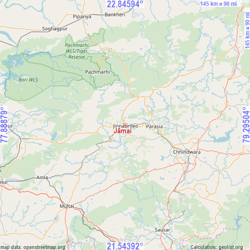
Jāmai GPS coordinates[2]
22° 11' 47.184" North, 78° 35' 30.876" East
| Map corner | latitude | longitude |
|---|---|---|
| Upper-left | 22.84594°, | 77.88879° |
| Center: | 22.19644°, | 78.59191° |
| Lower-right: | 21.54392°, | 79.29504° |
| Map W x H: | 144.8×144.8 km | = 90×90mi |
| max Lat: | 34.9274° ⇑55.2% North |
| Jāmai: | 22.19644° |
| min Lat: | ⇓44.8% South 8.09008° |
| min Long | Jāmai | max Long |
| 68.82655° | 78.59191° | 96.81° |
| W 55.1%⇐ | ⇒44.9% E |
Elevation
Elevation of Jāmai is 773 m = 2536 ft, and this is 477.4 m = 1566 ft above average elevation for this country.
| Max E: |
3681 m = 12077 ft | 6.6% |
| Jāmai | 773 m 2536 ft | |
| Avg. | 295.6 m = 970 ft | |
Min E: |
1 m = 3 ft | 93.4% |
See also: India elevation on elevation.city.
Geographical zone
Jāmai is located in North Torrid zone (between Equator and Tropic of Cancer). Distance of this Northern Tropic circle is 137.9 km =85.7 mi to North.| Distance of | km | miles | from Jāmai |
|---|---|---|---|
| North Pole | 7539 | 4684.5 | to North |
| Arctic Circle | 4933.2 | 3065.3 | to North |
| Tropic Cancer | 137.9 | 85.7 | to North |
| Equator | 2468 | 1533.5 | to South |


Nearby cities:
15 places around Jāmai: (largest is in red/bold)
• Amarwāra
60.5 km =37.6 mi,  79°
79°
• Amla
56.6 km =35.2 mi,  237°
237°
• Betūl Bazār
78.1 km =48.5 mi, 240°
• Chhindwāra
39 km =24.2 mi,  113°
113°
• Chichli
74.8 km =46.5 mi,  18°
18°
• Lodhīkheda
73.6 km =45.7 mi,  158°
158°
• Mohgaon
63.7 km =39.6 mi,  166°
166°
• Multai
58.2 km =36.2 mi,  216°
216°
• Pachmarhi
34.3 km =21.3 mi,  331°
331°
• Panara
4.3 km =2.7 mi,  283°
283°
• Parāsia
17.2 km =10.7 mi,  91°
91°
• Pāndhurnā
67.2 km =41.8 mi,  185°
185°
• Sausar
63.7 km =39.6 mi, 160°
• Shāhpur
70.5 km =43.8 mi,  269°
269°
• Sohāgpur
69.3 km =43.1 mi,  323°
323°
Sources, notices
• [Note1] Compared only with cities in India existing in our database
• [Src1] Map data: © OpenStreetMap contributors (CC-BY-SA)
• [Src2] Other city data from geonames.org with taken over terms of usage.
• [Src3] Geographical zone / Annual Mean Temperature by Robert A. Rohde @ Wikipedia
