Rāwah geodata
Rāwah (Anbar) is a seat of a second-order administrative division; located in Iraq in Asia/Baghdad (GMT+3) time zone. With population of 13,000 people, there are 70 cities with bigger population in this country. Compared to other cities in Iraq, 52.8% of cities are located further ↓South; 97.2% of cities are located further →East and 55.6% of cities have lower elevation than Rāwah. Note1


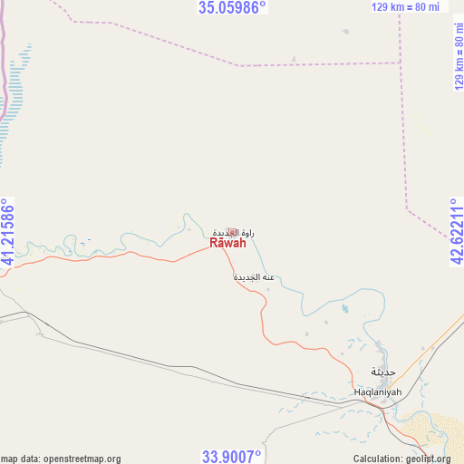
Rāwah GPS coordinates[2]
34° 28' 56.244" North, 41° 55' 8.328" East
| Map corner | latitude | longitude |
|---|---|---|
| Upper-left | 35.05986°, | 41.21586° |
| Center: | 34.48229°, | 41.91898° |
| Lower-right: | 33.9007°, | 42.62211° |
| Map W x H: | 128.9×128.9 km | = 80.1×80.1mi |
| max Lat: | 37.22781° ⇑47.2% North |
| Rāwah: | 34.48229° |
| min Lat: | ⇓52.8% South 29.97421° |
| min Long | Rāwah | max Long |
| 40.28586° | 41.91898° | 48.47309° |
| W 2.8%⇐ | ⇒97.2% E |
Elevation
Elevation of Rāwah is 186 m = 610 ft, and this is 107 m = 351 ft below average elevation for this country.
| Max E: |
1316 m = 4318 ft | 44.4% |
| Avg. | 293 m = 961 ft | |
| Rāwah | 186 m = 610 ft | |
Min E: |
1 m = 3 ft | 55.6% |
See also: Iraq elevation on elevation.city.
Geographical zone
Rāwah is located in North temperate zone (between Tropic of Cancer and the Arctic Circle). Distance of this Northern Tropic circle is 1228.2 km =763.2 mi to South.| Distance of | km | miles | from Rāwah |
|---|---|---|---|
| North Pole | 6173 | 3835.7 | to North |
| Arctic Circle | 3567.1 | 2216.5 | to North |
| Tropic Cancer | 1228.2 | 763.2 | to South |
| Equator | 3834.1 | 2382.4 | to South |


Nearby cities:
15 places around Rāwah: (largest is in red/bold)
• Ad Dawr
171.8 km =106.8 mi,  90°
90°
• Al Ba‘āj
174.5 km =108.4 mi,  353°
353°
• Al Qā’im
85.8 km =53.3 mi,  263°
263°
• Al Ḩaqlānīyah
60 km =37.3 mi,  137°
137°
• Al Ḩaḑar
142.2 km =88.4 mi,  31°
31°
• Al ‘Abbāsī
176.5 km =109.7 mi,  60°
60°
• Al ‘Awjah
166.3 km =103.3 mi, 88°
• Ash Sharqāt
165.7 km =103 mi,  46°
46°
• Bayjī
151.8 km =94.3 mi,  70°
70°
• Hīt
125.9 km =78.2 mi, 138°
• Ramadi
174.2 km =108.2 mi,  132°
132°
• Tikrīt
161.8 km =100.5 mi,  84°
84°
• Ḩadīthah
57 km =35.4 mi, 132°
• ‘Anah
13.9 km =8.6 mi,  155°
155°
• ‘Anat al Qadīmah
2.6 km =1.6 mi,  124°
124°
Sources, notices
• [Note1] Compared only with cities in Iraq existing in our database
• [Src1] Map data: © OpenStreetMap contributors (CC-BY-SA)
• [Src2] Other city data from geonames.org with taken over terms of usage.
• [Src3] Geographical zone / Annual Mean Temperature by Robert A. Rohde @ Wikipedia
