Ḩadīthah geodata
Ḩadīthah (Anbar) is a seat of a second-order administrative division; located in Iraq in Asia/Baghdad (GMT+3) time zone. With population of 30,925 people, there are 51 cities with bigger population in this country. Compared to other cities in Iraq, 52.1% of cities are located further ↑North; 94.4% of cities are located further →East and 51.4% of cities have higher elevation than Ḩadīthah. Note1


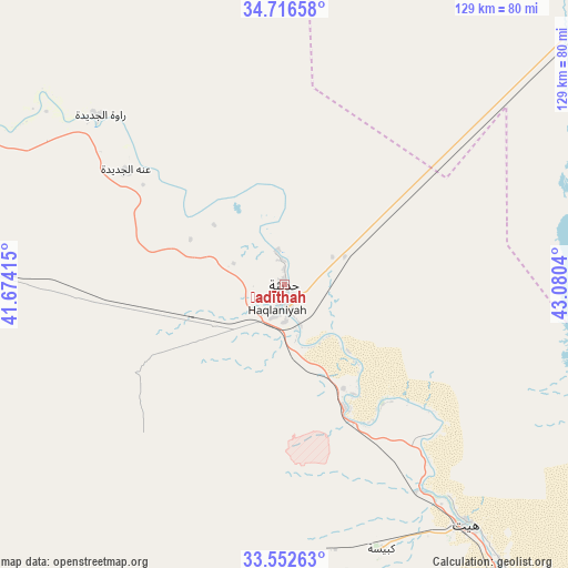
Ḩadīthah GPS coordinates[2]
34° 8' 11.796" North, 42° 22' 38.172" East
| Map corner | latitude | longitude |
|---|---|---|
| Upper-left | 34.71658°, | 41.67415° |
| Center: | 34.13661°, | 42.37727° |
| Lower-right: | 33.55263°, | 43.0804° |
| Map W x H: | 129.4×129.4 km | = 80.4×80.4mi |
| max Lat: | 37.22781° ⇑52.1% North |
| Ḩadīthah: | 34.13661° |
| min Lat: | ⇓47.9% South 29.97421° |
| min Long | Ḩadīthah | max Long |
| 40.28586° | 42.37727° | 48.47309° |
| W 5.6%⇐ | ⇒94.4% E |
Elevation
Elevation of Ḩadīthah is 121 m = 397 ft, and this is 172 m = 564 ft below average elevation for this country.
| Max E: |
1316 m = 4318 ft | 51.4% |
| Avg. | 293 m = 961 ft | |
| Ḩadīthah | 121 m = 397 ft | |
Min E: |
1 m = 3 ft | 48.6% |
See also: Iraq elevation on elevation.city.
Geographical zone
Ḩadīthah is located in North temperate zone (between Tropic of Cancer and the Arctic Circle). Distance of this Northern Tropic circle is 1189.7 km =739.2 mi to South.| Distance of | km | miles | from Ḩadīthah |
|---|---|---|---|
| North Pole | 6211.4 | 3859.6 | to North |
| Arctic Circle | 3605.5 | 2240.4 | to North |
| Tropic Cancer | 1189.7 | 739.2 | to South |
| Equator | 3795.6 | 2358.5 | to South |


Nearby cities:
15 places around Ḩadīthah: (largest is in red/bold)
• Ad Dawr
134.8 km =83.8 mi,  74°
74°
• Al Fallūjah
156.9 km =97.5 mi,  123°
123°
• Al Qā’im
130.7 km =81.2 mi,  282°
282°
• Al Ḩaqlānīyah
5.8 km =3.6 mi,  194°
194°
• Al Ḩaḑar
163 km =101.3 mi,  11°
11°
• Al ‘Awjah
132.1 km =82.1 mi, 70°
• Balad
163.4 km =101.5 mi,  94°
94°
• Bayjī
134.7 km =83.7 mi,  49°
49°
• Hīt
69.4 km =43.1 mi,  143°
143°
• Ramadi
117.2 km =72.8 mi,  132°
132°
• Rāwah
57 km =35.4 mi,  312°
312°
• Sāmarrā’
138.9 km =86.3 mi, 87°
• Tikrīt
130.8 km =81.3 mi, 65°
• ‘Anah
44.6 km =27.7 mi, 305°
• ‘Anat al Qadīmah
54.5 km =33.9 mi, 312°
Sources, notices
• [Note1] Compared only with cities in Iraq existing in our database
• [Src1] Map data: © OpenStreetMap contributors (CC-BY-SA)
• [Src2] Other city data from geonames.org with taken over terms of usage.
• [Src3] Geographical zone / Annual Mean Temperature by Robert A. Rohde @ Wikipedia
