Al Qā’im geodata
Al Qā’im (Anbar) is a seat of a second-order administrative division; located in Iraq in Asia/Baghdad (GMT+3) time zone. In our database, there are 71 cities with bigger population. Compared to other cities in Iraq, 50.7% of cities are located further ↓South; 99.3% of cities are located further →East and 53.5% of cities have lower elevation than Al Qā’im. Note1


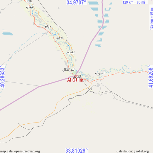
Al Qā’im GPS coordinates[2]
34° 23' 33.036" North, 40° 59' 22.02" East
| Map corner | latitude | longitude |
|---|---|---|
| Upper-left | 34.9707°, | 40.28633° |
| Center: | 34.39251°, | 40.98945° |
| Lower-right: | 33.81029°, | 41.69258° |
| Map W x H: | 129×129 km | = 80.2×80.2mi |
| max Lat: | 37.22781° ⇑49.3% North |
| Al Qā’im: | 34.39251° |
| min Lat: | ⇓50.7% South 29.97421° |
| min Long | Al Qā’im | max Long |
| 40.28586° | 40.98945° | 48.47309° |
| W 0.7%⇐ | ⇒99.3% E |
Elevation
Elevation of Al Qā’im is 180 m = 591 ft, and this is 113 m = 371 ft below average elevation for this country.
| Max E: |
1316 m = 4318 ft | 46.5% |
| Avg. | 293 m = 961 ft | |
| Al Qā’im | 180 m = 591 ft | |
Min E: |
1 m = 3 ft | 53.5% |
See also: Iraq elevation on elevation.city.
Geographical zone
Al Qā’im is located in North temperate zone (between Tropic of Cancer and the Arctic Circle). Distance of this Northern Tropic circle is 1218.2 km =757 mi to South.| Distance of | km | miles | from Al Qā’im |
|---|---|---|---|
| North Pole | 6183 | 3841.9 | to North |
| Arctic Circle | 3577.1 | 2222.7 | to North |
| Tropic Cancer | 1218.2 | 757 | to South |
| Equator | 3824.1 | 2376.2 | to South |


Nearby cities:
15 places around Al Qā’im: (largest is in red/bold)
• Al Ba‘āj
195 km =121.2 mi,  19°
19°
• Al Ḩaqlānīyah
130.7 km =81.2 mi,  105°
105°
• Al Ḩaḑar
206.1 km =128.1 mi,  50°
50°
• Al ‘Awjah
252 km =156.6 mi,  86°
86°
• Ar Ruţbah
164.1 km =102 mi,  203°
203°
• Ash Sharqāt
239.3 km =148.7 mi,  58°
58°
• Bayjī
236.2 km =146.8 mi,  75°
75°
• Hīt
189.1 km =117.5 mi,  116°
116°
• Ramadi
239.7 km =148.9 mi, 116°
• Rāwah
85.8 km =53.3 mi, 83°
• Sinjār
229 km =142.3 mi, 20°
• Tikrīt
247.6 km =153.9 mi, 84°
• Ḩadīthah
130.7 km =81.2 mi,  102°
102°
• ‘Anah
91.1 km =56.6 mi, 91°
• ‘Anat al Qadīmah
87.8 km =54.6 mi, 84°
Sources, notices
• [Note1] Compared only with cities in Iraq existing in our database
• [Src1] Map data: © OpenStreetMap contributors (CC-BY-SA)
• [Src2] Other city data from geonames.org with taken over terms of usage.
• [Src3] Geographical zone / Annual Mean Temperature by Robert A. Rohde @ Wikipedia
