‘Anat al Qadīmah geodata
‘Anat al Qadīmah (Anbar) is a destroyed populated place; located in Iraq in Asia/Baghdad (GMT+3) time zone. With population of 19,719 people, there are 68 cities with bigger population in this country. Compared to other cities in Iraq, 52.1% of cities are located further ↓South; 96.5% of cities are located further →East and 51.4% of cities have lower elevation than ‘Anat al Qadīmah. Note1


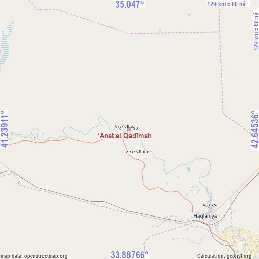
‘Anat al Qadīmah GPS coordinates[2]
34° 28' 9.624" North, 41° 56' 32.028" East
| Map corner | latitude | longitude |
|---|---|---|
| Upper-left | 35.047°, | 41.23911° |
| Center: | 34.46934°, | 41.94223° |
| Lower-right: | 33.88766°, | 42.64536° |
| Map W x H: | 128.9×128.9 km | = 80.1×80.1mi |
| max Lat: | 37.22781° ⇑47.9% North |
| ‘Anat al Qadīmah: | 34.46934° |
| min Lat: | ⇓52.1% South 29.97421° |
| min Long | ‘Anat al Qad� | max Long |
| 40.28586° | 41.94223° | 48.47309° |
| W 3.5%⇐ | ⇒96.5% E |
Elevation
Elevation of ‘Anat al Qadīmah is 171 m = 561 ft, and this is 122 m = 400 ft below average elevation for this country.
| Max E: |
1316 m = 4318 ft | 48.6% |
| Avg. | 293 m = 961 ft | |
| ‘Anat al Qadīmah | 171 m = 561 ft | |
Min E: |
1 m = 3 ft | 51.4% |
See also: Iraq elevation on elevation.city.
Geographical zone
‘Anat al Qadīmah is located in North temperate zone (between Tropic of Cancer and the Arctic Circle). Distance of this Northern Tropic circle is 1226.7 km =762.2 mi to South.| Distance of | km | miles | from ‘Anat al Qadīmah |
|---|---|---|---|
| North Pole | 6174.4 | 3836.6 | to North |
| Arctic Circle | 3568.5 | 2217.4 | to North |
| Tropic Cancer | 1226.7 | 762.2 | to South |
| Equator | 3832.6 | 2381.5 | to South |


Nearby cities:
15 places around ‘Anat al Qadīmah: (largest is in red/bold)
• Ad Dawr
169.7 km =105.4 mi,  90°
90°
• Al Ba‘āj
176.1 km =109.4 mi,  353°
353°
• Al Qā’im
87.8 km =54.6 mi,  264°
264°
• Al Ḩaqlānīyah
57.5 km =35.7 mi,  137°
137°
• Al Ḩaḑar
142.3 km =88.4 mi,  30°
30°
• Al ‘Abbāsī
175.5 km =109.1 mi,  59°
59°
• Al ‘Awjah
164.3 km =102.1 mi, 87°
• Ash Sharqāt
165.2 km =102.7 mi,  45°
45°
• Bayjī
150.3 km =93.4 mi,  70°
70°
• Hīt
123.4 km =76.7 mi, 138°
• Ramadi
171.6 km =106.6 mi,  132°
132°
• Rāwah
2.6 km =1.6 mi,  304°
304°
• Tikrīt
159.9 km =99.4 mi,  84°
84°
• Ḩadīthah
54.5 km =33.9 mi, 132°
• ‘Anah
11.8 km =7.3 mi,  161°
161°
Sources, notices
• [Note1] Compared only with cities in Iraq existing in our database
• [Src1] Map data: © OpenStreetMap contributors (CC-BY-SA)
• [Src2] Other city data from geonames.org with taken over terms of usage.
• [Src3] Geographical zone / Annual Mean Temperature by Robert A. Rohde @ Wikipedia
