Dare Tû geodata
Dare Tû (Arbīl) is a seat of a third-order administrative division; located in Iraq in Asia/Baghdad (GMT+3) time zone. In our database, there are 71 cities with bigger population. Compared to other cities in Iraq, 74.6% of cities are located further ↓South; 64.8% of cities are located further →East and 73.2% of cities have lower elevation than Dare Tû. Note1


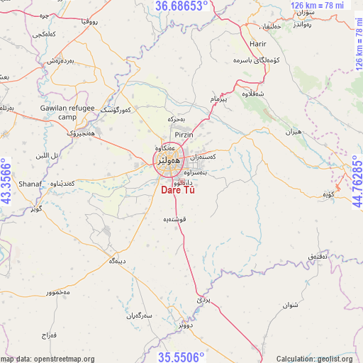
Dare Tû GPS coordinates[2]
36° 7' 14.232" North, 44° 3' 34.992" East
| Map corner | latitude | longitude |
|---|---|---|
| Upper-left | 36.68653°, | 43.3566° |
| Center: | 36.12062°, | 44.05972° |
| Lower-right: | 35.5506°, | 44.76285° |
| Map W x H: | 126.3×126.3 km | = 78.5×78.5mi |
| max Lat: | 37.22781° ⇑25.4% North |
| Dare Tû: | 36.12062° |
| min Lat: | ⇓74.6% South 29.97421° |
| min Long | Dare Tû | max Long |
| 40.28586° | 44.05972° | 48.47309° |
| W 35.2%⇐ | ⇒64.8% E |
Elevation
Elevation of Dare Tû is 439 m = 1440 ft, and this is 146 m = 479 ft above average elevation for this country.
| Max E: |
1316 m = 4318 ft | 26.8% |
| Dare Tû | 439 m 1440 ft | |
| Avg. | 293 m = 961 ft | |
Min E: |
1 m = 3 ft | 73.2% |
See also: Iraq elevation on elevation.city.
Geographical zone
Dare Tû is located in North temperate zone (between Tropic of Cancer and the Arctic Circle). Distance of this Northern Tropic circle is 1410.3 km =876.3 mi to South.| Distance of | km | miles | from Dare Tû |
|---|---|---|---|
| North Pole | 5990.8 | 3722.5 | to North |
| Arctic Circle | 3384.9 | 2103.3 | to North |
| Tropic Cancer | 1410.3 | 876.3 | to South |
| Equator | 4016.2 | 2495.6 | to South |


Nearby cities:
15 places around Dare Tû: (largest is in red/bold)
• Al-Hamdaniya
63.4 km =39.4 mi,  285°
285°
• Beḧirke
21.8 km =13.5 mi,  354°
354°
• Dibis
49.6 km =30.8 mi,  178°
178°
• Erbil
8.2 km =5.1 mi,  328°
328°
• Hīrān
42.6 km =26.5 mi,  65°
65°
• Kasnazān
11 km =6.8 mi,  36°
36°
• Koysinceq
51.3 km =31.9 mi,  94°
94°
• Mexmur
57.7 km =35.9 mi,  228°
228°
• Nāḩiyat Hīrān
42.3 km =26.3 mi, 65°
• Qushtepe
13.3 km =8.3 mi,  188°
188°
• Ruwāndiz
68.6 km =42.6 mi, 37°
• Shaqlāwah
39.5 km =24.5 mi, 37°
• Xebat
39 km =24.2 mi,  296°
296°
• ‘Aqrah
72.7 km =45.2 mi, 348°
• ‘Aynkāwah
13.6 km =8.5 mi, 334°
Sources, notices
• [Note1] Compared only with cities in Iraq existing in our database
• [Src1] Map data: © OpenStreetMap contributors (CC-BY-SA)
• [Src2] Other city data from geonames.org with taken over terms of usage.
• [Src3] Geographical zone / Annual Mean Temperature by Robert A. Rohde @ Wikipedia
