Xebat geodata
Xebat (Arbīl) is a seat of a second-order administrative division; located in Iraq in Asia/Baghdad (GMT+3) time zone. In our database, there are 71 cities with bigger population. Compared to other cities in Iraq, 81.7% of cities are located further ↓South; 74.6% of cities are located further →East and 66.2% of cities have lower elevation than Xebat. Note1


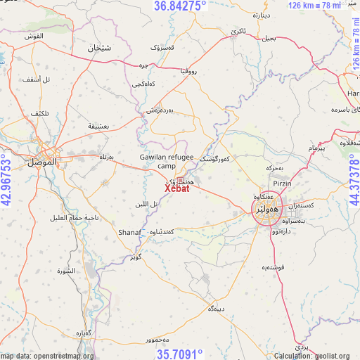
Xebat GPS coordinates[2]
36° 16' 40.728" North, 43° 40' 14.34" East
| Map corner | latitude | longitude |
|---|---|---|
| Upper-left | 36.84275°, | 42.96753° |
| Center: | 36.27798°, | 43.67065° |
| Lower-right: | 35.7091°, | 44.37378° |
| Map W x H: | 126.1×126 km | = 78.4×78.3mi |
| max Lat: | 37.22781° ⇑18.3% North |
| Xebat: | 36.27798° |
| min Lat: | ⇓81.7% South 29.97421° |
| min Long | Xebat | max Long |
| 40.28586° | 43.67065° | 48.47309° |
| W 25.4%⇐ | ⇒74.6% E |
Elevation
Elevation of Xebat is 280 m = 919 ft, and this is 13 m = 43 ft below average elevation for this country.
| Max E: |
1316 m = 4318 ft | 33.8% |
| Avg. | 293 m = 961 ft | |
| Xebat | 280 m = 919 ft | |
Min E: |
1 m = 3 ft | 66.2% |
See also: Iraq elevation on elevation.city.
Geographical zone
Xebat is located in North temperate zone (between Tropic of Cancer and the Arctic Circle). Distance of this Northern Tropic circle is 1427.8 km =887.2 mi to South.| Distance of | km | miles | from Xebat |
|---|---|---|---|
| North Pole | 5973.3 | 3711.6 | to North |
| Arctic Circle | 3367.4 | 2092.4 | to North |
| Tropic Cancer | 1427.8 | 887.2 | to South |
| Equator | 4033.7 | 2506.4 | to South |


Nearby cities:
15 places around Xebat: (largest is in red/bold)
• Al Mawşil al Jadīdah
51 km =31.7 mi,  276°
276°
• Al Qayyārah
63.1 km =39.2 mi,  212°
212°
• Al-Hamdaniya
26.3 km =16.3 mi,  268°
268°
• Ash Shaykhān
54.5 km =33.9 mi,  328°
328°
• Beḧirke
32.9 km =20.4 mi,  82°
82°
• Dare Tû
39 km =24.2 mi,  116°
116°
• Erbil
32.4 km =20.1 mi,  108°
108°
• Kasnazān
42.3 km =26.3 mi,  101°
101°
• Mexmur
56.4 km =35 mi,  188°
188°
• Mosul
49.8 km =30.9 mi, 277°
• Qushtepe
45.1 km =28 mi,  132°
132°
• Shaqlāwah
60.3 km =37.5 mi, 76°
• Tallkayf
54.6 km =33.9 mi,  295°
295°
• ‘Aqrah
57.2 km =35.5 mi,  20°
20°
• ‘Aynkāwah
29.5 km =18.3 mi, 100°
Sources, notices
• [Note1] Compared only with cities in Iraq existing in our database
• [Src1] Map data: © OpenStreetMap contributors (CC-BY-SA)
• [Src2] Other city data from geonames.org with taken over terms of usage.
• [Src3] Geographical zone / Annual Mean Temperature by Robert A. Rohde @ Wikipedia
