Hashtpar geodata
Hashtpar (Gīlān) is a seat of a second-order administrative division; located in Iran in Asia/Tehran (GMT+3.5) time zone. With population of 45,305 people, there are 144 cities with bigger population in this country. Compared to other cities in Iran, 93.4% of cities are located further ↓South; 72.6% of cities are located further →East and 83.7% of cities have higher elevation than Hashtpar. Note1


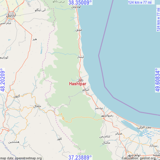
Hashtpar GPS coordinates[2]
37° 47' 47.688" North, 48° 54' 18.756" East
| Map corner | latitude | longitude |
|---|---|---|
| Upper-left | 38.35009°, | 48.20209° |
| Center: | 37.79658°, | 48.90521° |
| Lower-right: | 37.23889°, | 49.60834° |
| Map W x H: | 123.6×123.6 km | = 76.8×76.8mi |
| max Lat: | 39.6482° ⇑6.6% North |
| Hashtpar: | 37.79658° |
| min Lat: | ⇓93.4% South 25.2919° |
| min Long | Hashtpar | max Long |
| 44.38416° | 48.90521° | 61.9965° |
| W 27.4%⇐ | ⇒72.6% E |
Elevation
Elevation of Hashtpar is 57 m = 187 ft, and this is 992 m = 3255 ft below average elevation for this country.
| Max E: |
2564 m = 8412 ft | 83.7% |
| Avg. | 1049 m = 3442 ft | |
| Hashtpar | 57 m = 187 ft | |
Min E: |
-24 m = -79 ft | 16.3% |
See also: Hashtpar elevation on elevation.city.
Geographical zone
Hashtpar is located in North temperate zone (between Tropic of Cancer and the Arctic Circle). Distance of this Northern Tropic circle is 1596.7 km =992.1 mi to South.| Distance of | km | miles | from Hashtpar |
|---|---|---|---|
| North Pole | 5804.5 | 3606.7 | to North |
| Arctic Circle | 3198.6 | 1987.5 | to North |
| Tropic Cancer | 1596.7 | 992.1 | to South |
| Equator | 4202.6 | 2611.4 | to South |


Nearby cities:
15 places around Hashtpar: (largest is in red/bold)
• Ardabīl
73.6 km =45.7 mi,  313°
313°
• Bandar-e Anzalī
60.5 km =37.6 mi,  126°
126°
• Fūman
73.1 km =45.4 mi,  150°
150°
• Gīvī
51 km =31.7 mi,  256°
256°
• Khalkhāl
38.6 km =24 mi,  239°
239°
• Māsāl
52.2 km =32.4 mi,  157°
157°
• Māsūleh
71.7 km =44.6 mi,  174°
174°
• Namīn
79.2 km =49.2 mi,  332°
332°
• Nīr
83.8 km =52.1 mi,  288°
288°
• Rasht
83.5 km =51.9 mi, 133°
• Reẕvānshahr
34.2 km =21.3 mi,  143°
143°
• Shaft
82.2 km =51.1 mi, 147°
• Ziabar (Gaskar)
51 km =31.7 mi, 143°
• Āstārā
70.4 km =43.7 mi,  357°
357°
• Şowme‘eh Sarā
65.9 km =40.9 mi, 146°
Sources, notices
• [Note1] Compared only with cities in Iran existing in our database
• [Src1] Map data: © OpenStreetMap contributors (CC-BY-SA)
• [Src2] Other city data from geonames.org with taken over terms of usage.
• [Src3] Geographical zone / Annual Mean Temperature by Robert A. Rohde @ Wikipedia
