Khalkhāl geodata
Khalkhāl (Ardabīl) is a seat of a second-order administrative division; located in Iran in Asia/Tehran (GMT+3.5) time zone. With population of 51,024 people, there are 126 cities with bigger population in this country. Compared to other cities in Iran, 92.5% of cities are located further ↓South; 75.5% of cities are located further →East and 85.7% of cities have lower elevation than Khalkhāl. Note1


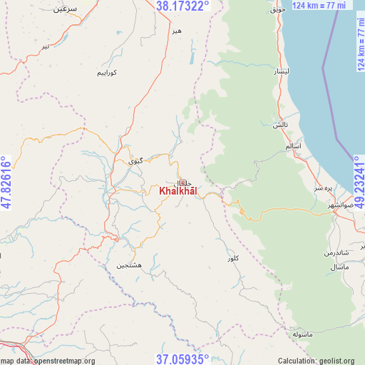
Khalkhāl GPS coordinates[2]
37° 37' 6.132" North, 48° 31' 45.408" East
| Map corner | latitude | longitude |
|---|---|---|
| Upper-left | 38.17322°, | 47.82616° |
| Center: | 37.61837°, | 48.52928° |
| Lower-right: | 37.05935°, | 49.23241° |
| Map W x H: | 123.9×123.9 km | = 77×77mi |
| max Lat: | 39.6482° ⇑7.5% North |
| Khalkhāl: | 37.61837° |
| min Lat: | ⇓92.5% South 25.2919° |
| min Long | Khalkhāl | max Long |
| 44.38416° | 48.52928° | 61.9965° |
| W 24.5%⇐ | ⇒75.5% E |
Elevation
Elevation of Khalkhāl is 1795 m = 5889 ft, and this is 746 m = 2448 ft above average elevation for this country.
| Max E: |
2564 m = 8412 ft | 14.3% |
| Khalkhāl | 1795 m 5889 ft | |
| Avg. | 1049 m = 3442 ft | |
Min E: |
-24 m = -79 ft | 85.7% |
See also: Khalkhāl elevation on elevation.city.
Geographical zone
Khalkhāl is located in North temperate zone (between Tropic of Cancer and the Arctic Circle). Distance of this Northern Tropic circle is 1576.9 km =979.8 mi to South.| Distance of | km | miles | from Khalkhāl |
|---|---|---|---|
| North Pole | 5824.3 | 3619.1 | to North |
| Arctic Circle | 3218.4 | 1999.8 | to North |
| Tropic Cancer | 1576.9 | 979.8 | to South |
| Equator | 4182.8 | 2599.1 | to South |


Nearby cities:
15 places around Khalkhāl: (largest is in red/bold)
• Ardabīl
73.2 km =45.5 mi,  343°
343°
• Bandar-e Anzalī
83.4 km =51.8 mi,  101°
101°
• Fūman
81.9 km =50.9 mi,  122°
122°
• Gīvī
18.1 km =11.2 mi,  294°
294°
• Hashtpar
38.6 km =24 mi,  59°
59°
• Māsāl
60.3 km =37.5 mi, 118°
• Māsūleh
65.7 km =40.8 mi,  141°
141°
• Mīāneh
75.1 km =46.7 mi,  253°
253°
• Namīn
90 km =55.9 mi,  357°
357°
• Nīr
65.7 km =40.8 mi,  314°
314°
• Omīdcheh
81.7 km =50.8 mi, 335°
• Reẕvānshahr
54.1 km =33.6 mi, 98°
• Ziabar (Gaskar)
66.7 km =41.4 mi,  108°
108°
• Ābbar
85.8 km =53.3 mi,  153°
153°
• Şowme‘eh Sarā
77.8 km =48.3 mi, 116°
Sources, notices
• [Note1] Compared only with cities in Iran existing in our database
• [Src1] Map data: © OpenStreetMap contributors (CC-BY-SA)
• [Src2] Other city data from geonames.org with taken over terms of usage.
• [Src3] Geographical zone / Annual Mean Temperature by Robert A. Rohde @ Wikipedia
