Namīn geodata
Namīn (Ardabīl) is a seat of a second-order administrative division; located in Iran in Asia/Tehran (GMT+3.5) time zone. In our database, there are 232 cities with bigger population. Compared to other cities in Iran, 96.4% of cities are located further ↓South; 76.2% of cities are located further →East and 66.4% of cities have lower elevation than Namīn. Note1


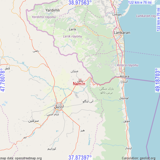
Namīn GPS coordinates[2]
38° 25' 36.84" North, 48° 29' 2.04" East
| Map corner | latitude | longitude |
|---|---|---|
| Upper-left | 38.97563°, | 47.78078° |
| Center: | 38.4269°, | 48.4839° |
| Lower-right: | 37.87397°, | 49.18703° |
| Map W x H: | 122.5×122.5 km | = 76.1×76.1mi |
| max Lat: | 39.6482° ⇑3.6% North |
| Namīn: | 38.4269° |
| min Lat: | ⇓96.4% South 25.2919° |
| min Long | Namīn | max Long |
| 44.38416° | 48.4839° | 61.9965° |
| W 23.8%⇐ | ⇒76.2% E |
Elevation
Elevation of Namīn is 1429 m = 4688 ft, and this is 380 m = 1247 ft above average elevation for this country.
| Max E: |
2564 m = 8412 ft | 33.6% |
| Namīn | 1429 m 4688 ft | |
| Avg. | 1049 m = 3442 ft | |
Min E: |
-24 m = -79 ft | 66.4% |
See also: Iran elevation on elevation.city.
Geographical zone
Namīn is located in North temperate zone (between Tropic of Cancer and the Arctic Circle). Distance of this Northern Tropic circle is 1666.8 km =1035.7 mi to South.| Distance of | km | miles | from Namīn |
|---|---|---|---|
| North Pole | 5734.4 | 3563.2 | to North |
| Arctic Circle | 3128.5 | 1944 | to North |
| Tropic Cancer | 1666.8 | 1035.7 | to South |
| Equator | 4272.7 | 2654.9 | to South |


Nearby cities:
15 places around Namīn: (largest is in red/bold)
• Ahar
123.3 km =76.6 mi,  272°
272°
• Ardabīl
25.8 km =16 mi,  220°
220°
• Bīleh Savār
106.5 km =66.2 mi,  353°
353°
• Germī
74.8 km =46.5 mi,  332°
332°
• Gīvī
83.3 km =51.8 mi,  188°
188°
• Hashtpar
79.2 km =49.2 mi,  152°
152°
• Herīs
120.9 km =75.1 mi,  260°
260°
• Khalkhāl
90 km =55.9 mi,  177°
177°
• Meshgīn Shahr
69.9 km =43.4 mi, 267°
• Nīr
60.8 km =37.8 mi, 224°
• Omīdcheh
33.7 km =20.9 mi,  242°
242°
• Reẕvānshahr
113.1 km =70.3 mi, 149°
• Sarāb
98.9 km =61.5 mi, 236°
• Ziabar (Gaskar)
129.8 km =80.7 mi, 149°
• Āstārā
33.8 km =21 mi,  89°
89°
Sources, notices
• [Note1] Compared only with cities in Iran existing in our database
• [Src1] Map data: © OpenStreetMap contributors (CC-BY-SA)
• [Src2] Other city data from geonames.org with taken over terms of usage.
• [Src3] Geographical zone / Annual Mean Temperature by Robert A. Rohde @ Wikipedia
