Qaşr-e Shīrīn geodata
Qaşr-e Shīrīn (Kermānshāh) is a seat of a second-order administrative division; located in Iran in Asia/Tehran (GMT+3.5) time zone. In our database, there are 232 cities with bigger population. Compared to other cities in Iran, 51.5% of cities are located further ↓South; 97.3% of cities are located further →East and 76.4% of cities have higher elevation than Qaşr-e Shīrīn. Note1


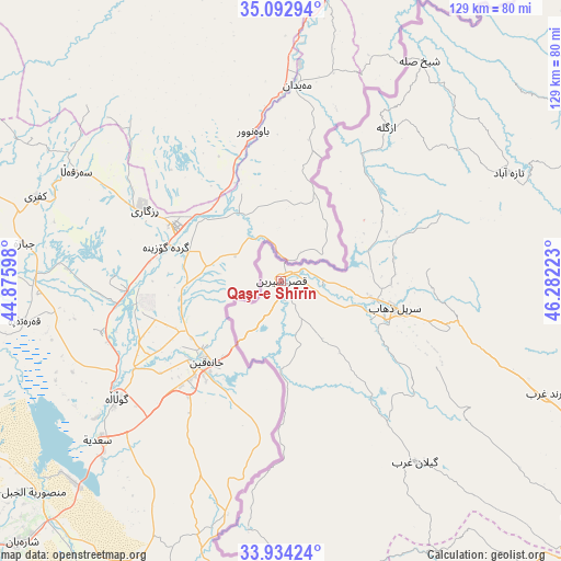
Qaşr-e Shīrīn GPS coordinates[2]
34° 30' 56.16" North, 45° 34' 44.76" East
| Map corner | latitude | longitude |
|---|---|---|
| Upper-left | 35.09294°, | 44.87598° |
| Center: | 34.5156°, | 45.5791° |
| Lower-right: | 33.93424°, | 46.28223° |
| Map W x H: | 128.8×128.8 km | = 80×80mi |
| max Lat: | 39.6482° ⇑48.5% North |
| Qaşr-e Shīrīn: | 34.5156° |
| min Lat: | ⇓51.5% South 25.2919° |
| min Long | Qaşr-e Shīrī | max Long |
| 44.38416° | 45.5791° | 61.9965° |
| W 2.7%⇐ | ⇒97.3% E |
Elevation
Elevation of Qaşr-e Shīrīn is 363 m = 1191 ft, and this is 686 m = 2251 ft below average elevation for this country.
| Max E: |
2564 m = 8412 ft | 76.4% |
| Avg. | 1049 m = 3442 ft | |
| Qaşr-e Shīrīn | 363 m = 1191 ft | |
Min E: |
-24 m = -79 ft | 23.6% |
See also: Iran elevation on elevation.city.
Geographical zone
Qaşr-e Shīrīn is located in North temperate zone (between Tropic of Cancer and the Arctic Circle). Distance of this Northern Tropic circle is 1231.9 km =765.5 mi to South.| Distance of | km | miles | from Qaşr-e Shīrīn |
|---|---|---|---|
| North Pole | 6169.3 | 3833.4 | to North |
| Arctic Circle | 3563.4 | 2214.2 | to North |
| Tropic Cancer | 1231.9 | 765.5 | to South |
| Equator | 3837.8 | 2384.7 | to South |


Nearby cities:
15 places around Qaşr-e Shīrīn: (largest is in red/bold)
• Eslāmābād-e Gharb
98.1 km =61 mi,  117°
117°
• Eyvān
101.9 km =63.3 mi,  138°
138°
• Gīlān-e Gharb
52 km =32.3 mi, 142°
• Javānrūd
89.5 km =55.6 mi,  68°
68°
• Javānrūd
91.3 km =56.7 mi, 70°
• Kerend-e Gharb
66.1 km =41.1 mi,  112°
112°
• Kāmyārān
127.9 km =79.5 mi,  75°
75°
• Marīvān
124.3 km =77.2 mi,  26°
26°
• Pāveh
92.1 km =57.2 mi,  50°
50°
• Ravānsar
100.8 km =62.6 mi, 77°
• Sarpol-e Z̄ahāb
26.7 km =16.6 mi,  103°
103°
• Sarvābād
114.1 km =70.9 mi,  39°
39°
• Sarābleh
123.1 km =76.5 mi,  132°
132°
• Tāzehābād
57.8 km =35.9 mi,  64°
64°
• Īlām
124.8 km =77.5 mi, 141°
Sources, notices
• [Note1] Compared only with cities in Iran existing in our database
• [Src1] Map data: © OpenStreetMap contributors (CC-BY-SA)
• [Src2] Other city data from geonames.org with taken over terms of usage.
• [Src3] Geographical zone / Annual Mean Temperature by Robert A. Rohde @ Wikipedia
