Īlām geodata
Īlām (Ilam Province) is a seat of a first-order administrative division; located in Iran in Asia/Tehran (GMT+3.5) time zone. With population of 140,940 people, there are 51 cities with bigger population in this country. Compared to other cities in Iran, 56.5% of cities are located further ↑North; 91.2% of cities are located further →East and 65.1% of cities have lower elevation than Īlām. Note1


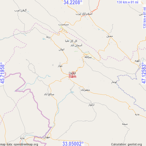
Īlām GPS coordinates[2]
33° 38' 14.64" North, 46° 25' 21.72" East
| Map corner | latitude | longitude |
|---|---|---|
| Upper-left | 34.2208°, | 45.71958° |
| Center: | 33.6374°, | 46.4227° |
| Lower-right: | 33.05002°, | 47.12583° |
| Map W x H: | 130.2×130.2 km | = 80.9×80.9mi |
| max Lat: | 39.6482° ⇑56.5% North |
| Īlām: | 33.6374° |
| min Lat: | ⇓43.5% South 25.2919° |
| min Long | Īlām | max Long |
| 44.38416° | 46.4227° | 61.9965° |
| W 8.8%⇐ | ⇒91.2% E |
Elevation
Elevation of Īlām is 1403 m = 4603 ft, and this is 354 m = 1161 ft above average elevation for this country.
| Max E: |
2564 m = 8412 ft | 34.9% |
| Īlām | 1403 m 4603 ft | |
| Avg. | 1049 m = 3442 ft | |
Min E: |
-24 m = -79 ft | 65.1% |
See also: Īlām elevation on elevation.city.
Geographical zone
Īlām is located in North temperate zone (between Tropic of Cancer and the Arctic Circle). Distance of this Northern Tropic circle is 1134.2 km =704.8 mi to South.| Distance of | km | miles | from Īlām |
|---|---|---|---|
| North Pole | 6266.9 | 3894.1 | to North |
| Arctic Circle | 3661 | 2274.8 | to North |
| Tropic Cancer | 1134.2 | 704.8 | to South |
| Equator | 3740.1 | 2324 | to South |


Nearby cities:
15 places around Īlām: (largest is in red/bold)
• Arakvāz-e Malekshāhī
32.7 km =20.3 mi,  150°
150°
• Darreh Shahr
104.4 km =64.9 mi,  121°
121°
• Eslāmābād-e Gharb
53.4 km =33.2 mi,  10°
10°
• Eyvān
23.5 km =14.6 mi,  333°
333°
• Gīlān-e Gharb
72.8 km =45.2 mi,  320°
320°
• Kahrīz
101.4 km =63 mi,  35°
35°
• Kerend-e Gharb
73.8 km =45.9 mi,  346°
346°
• Kermanshah
95.8 km =59.5 mi, 38°
• Kūhdasht
110.6 km =68.7 mi,  96°
96°
• Mehrān
62.1 km =38.6 mi,  202°
202°
• Qaşr-e Shīrīn
124.8 km =77.5 mi, 321°
• Ravānsar
121.7 km =75.6 mi, 10°
• Sarpol-e Z̄ahāb
105.1 km =65.3 mi, 330°
• Sarābleh
19.6 km =12.2 mi, 42°
• Ābdānān
117.1 km =72.8 mi,  127°
127°
Sources, notices
• [Note1] Compared only with cities in Iran existing in our database
• [Src1] Map data: © OpenStreetMap contributors (CC-BY-SA)
• [Src2] Other city data from geonames.org with taken over terms of usage.
• [Src3] Geographical zone / Annual Mean Temperature by Robert A. Rohde @ Wikipedia
