Sarpol-e Z̄ahāb geodata
Sarpol-e Z̄ahāb (Kermānshāh) is a seat of a second-order administrative division; located in Iran in Asia/Tehran (GMT+3.5) time zone. With population of 51,611 people, there are 124 cities with bigger population in this country. Compared to other cities in Iran, 50.6% of cities are located further ↓South; 96.1% of cities are located further →East and 72.6% of cities have higher elevation than Sarpol-e Z̄ahāb. Note1


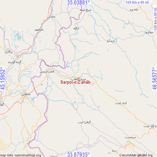
Sarpol-e Z̄ahāb GPS coordinates[2]
34° 27' 39.924" North, 45° 51' 45.504" East
| Map corner | latitude | longitude |
|---|---|---|
| Upper-left | 35.03881°, | 45.15952° |
| Center: | 34.46109°, | 45.86264° |
| Lower-right: | 33.87935°, | 46.56577° |
| Map W x H: | 128.9×128.9 km | = 80.1×80.1mi |
| max Lat: | 39.6482° ⇑49.4% North |
| Sarpol-e Z̄ahāb: | 34.46109° |
| min Lat: | ⇓50.6% South 25.2919° |
| min Long | Sarpol-e Z̄ah� | max Long |
| 44.38416° | 45.86264° | 61.9965° |
| W 3.9%⇐ | ⇒96.1% E |
Elevation
Elevation of Sarpol-e Z̄ahāb is 547 m = 1795 ft, and this is 502 m = 1647 ft below average elevation for this country.
| Max E: |
2564 m = 8412 ft | 72.6% |
| Avg. | 1049 m = 3442 ft | |
| Sarpol-e Z̄ahāb | 547 m = 1795 ft | |
Min E: |
-24 m = -79 ft | 27.4% |
See also: Sarpol-e Z̄ahāb elevation on elevation.city.
Geographical zone
Sarpol-e Z̄ahāb is located in North temperate zone (between Tropic of Cancer and the Arctic Circle). Distance of this Northern Tropic circle is 1225.8 km =761.7 mi to South.| Distance of | km | miles | from Sarpol-e Z̄ahāb |
|---|---|---|---|
| North Pole | 6175.3 | 3837.2 | to North |
| Arctic Circle | 3569.5 | 2218 | to North |
| Tropic Cancer | 1225.8 | 761.7 | to South |
| Equator | 3831.7 | 2380.9 | to South |


Nearby cities:
15 places around Sarpol-e Z̄ahāb: (largest is in red/bold)
• Eslāmābād-e Gharb
72.5 km =45 mi,  122°
122°
• Eyvān
81.6 km =50.7 mi,  149°
149°
• Gīlān-e Gharb
35.9 km =22.3 mi,  171°
171°
• Javānrūd
69.2 km =43 mi,  56°
56°
• Javānrūd
70.5 km =43.8 mi, 58°
• Kahrīz
109.7 km =68.2 mi,  94°
94°
• Kerend-e Gharb
40 km =24.9 mi, 119°
• Kāmyārān
105 km =65.2 mi,  69°
69°
• Pāveh
78.9 km =49 mi,  34°
34°
• Qaşr-e Shīrīn
26.7 km =16.6 mi,  283°
283°
• Ravānsar
77.7 km =48.3 mi, 68°
• Sarvābād
105.3 km =65.4 mi, 25°
• Sarābleh
100.7 km =62.6 mi,  139°
139°
• Tāzehābād
40.5 km =25.2 mi,  40°
40°
• Īlām
105.1 km =65.3 mi, 150°
Sources, notices
• [Note1] Compared only with cities in Iran existing in our database
• [Src1] Map data: © OpenStreetMap contributors (CC-BY-SA)
• [Src2] Other city data from geonames.org with taken over terms of usage.
• [Src3] Geographical zone / Annual Mean Temperature by Robert A. Rohde @ Wikipedia
