Gīlān-e Gharb geodata
Gīlān-e Gharb (Kermānshāh) is a seat of a second-order administrative division; located in Iran in Asia/Tehran (GMT+3.5) time zone. In our database, there are 232 cities with bigger population. Compared to other cities in Iran, 51.5% of cities are located further ↑North; 95.5% of cities are located further →East and 66.9% of cities have higher elevation than Gīlān-e Gharb. Note1


Gīlān-e Gharb GPS coordinates[2]
34° 8' 31.56" North, 45° 55' 13.08" East
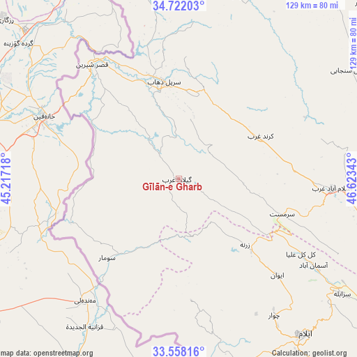
| Map corner | latitude | longitude |
|---|---|---|
| Upper-left | 34.72203°, | 45.21718° |
| Center: | 34.1421°, | 45.9203° |
| Lower-right: | 33.55816°, | 46.62343° |
| Map W x H: | 129.4×129.4 km | = 80.4×80.4mi |
| max Lat: | 39.6482° ⇑51.5% North |
| Gīlān-e Gharb: | 34.1421° |
| min Lat: | ⇓48.5% South 25.2919° |
| min Long | Gīlān-e Gharb | max Long |
| 44.38416° | 45.9203° | 61.9965° |
| W 4.5%⇐ | ⇒95.5% E |
Elevation
Elevation of Gīlān-e Gharb is 802 m = 2631 ft, and this is 247 m = 810 ft below average elevation for this country.
| Max E: |
2564 m = 8412 ft | 66.9% |
| Avg. | 1049 m = 3442 ft | |
| Gīlān-e Gharb | 802 m = 2631 ft | |
Min E: |
-24 m = -79 ft | 33.1% |
See also: Iran elevation on elevation.city.
Geographical zone
Gīlān-e Gharb is located in North temperate zone (between Tropic of Cancer and the Arctic Circle). Distance of this Northern Tropic circle is 1190.3 km =739.6 mi to South.| Distance of | km | miles | from Gīlān-e Gharb |
|---|---|---|---|
| North Pole | 6210.8 | 3859.2 | to North |
| Arctic Circle | 3604.9 | 2240 | to North |
| Tropic Cancer | 1190.3 | 739.6 | to South |
| Equator | 3796.2 | 2358.8 | to South |


Nearby cities:
15 places around Gīlān-e Gharb: (largest is in red/bold)
• Arakvāz-e Malekshāhī
105.1 km =65.3 mi,  143°
143°
• Eslāmābād-e Gharb
56 km =34.8 mi,  93°
93°
• Eyvān
50.1 km =31.1 mi,  134°
134°
• Javānrūd
90.6 km =56.3 mi,  35°
35°
• Javānrūd
91 km =56.5 mi, 36°
• Kahrīz
107.7 km =66.9 mi,  75°
75°
• Kerend-e Gharb
33.6 km =20.9 mi,  61°
61°
• Kermanshah
107 km =66.5 mi, 79°
• Pāveh
107.9 km =67 mi,  21°
21°
• Qaşr-e Shīrīn
52 km =32.3 mi,  322°
322°
• Ravānsar
92.6 km =57.5 mi,  46°
46°
• Sarpol-e Z̄ahāb
35.9 km =22.3 mi,  351°
351°
• Sarābleh
72.6 km =45.1 mi,  124°
124°
• Tāzehābād
69.6 km =43.2 mi, 17°
• Īlām
72.8 km =45.2 mi, 140°
Sources, notices
• [Note1] Compared only with cities in Iran existing in our database
• [Src1] Map data: © OpenStreetMap contributors (CC-BY-SA)
• [Src2] Other city data from geonames.org with taken over terms of usage.
• [Src3] Geographical zone / Annual Mean Temperature by Robert A. Rohde @ Wikipedia
