Arakvāz-e Malekshāhī geodata
Arakvāz-e Malekshāhī (Ilam Province) is a seat of a second-order administrative division; located in Iran in Asia/Tehran (GMT+3.5) time zone. In our database, there are 232 cities with bigger population. Compared to other cities in Iran, 59.4% of cities are located further ↑North; 89.8% of cities are located further →East and 59.9% of cities have lower elevation than Arakvāz-e Malekshāhī. Note1


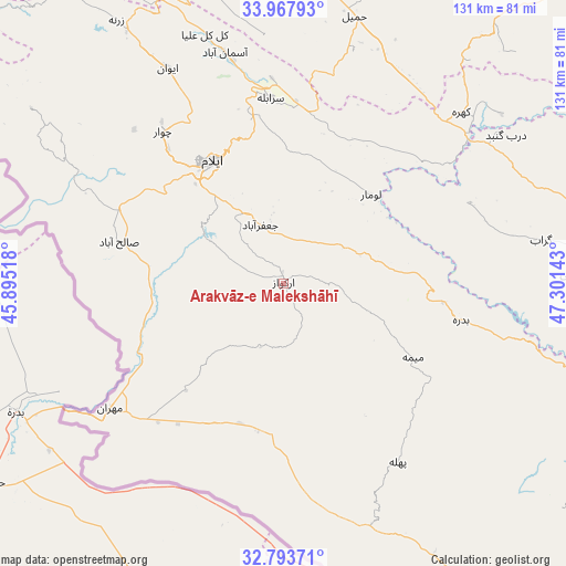
Arakvāz-e Malekshāhī GPS coordinates[2]
33° 22' 58.08" North, 46° 35' 53.88" East
| Map corner | latitude | longitude |
|---|---|---|
| Upper-left | 33.96793°, | 45.89518° |
| Center: | 33.3828°, | 46.5983° |
| Lower-right: | 32.79371°, | 47.30143° |
| Map W x H: | 130.6×130.6 km | = 81.2×81.2mi |
| max Lat: | 39.6482° ⇑59.4% North |
| Arakvāz-e Malekshāhī: | 33.3828° |
| min Lat: | ⇓40.6% South 25.2919° |
| min Long | Arakvāz-e Male | max Long |
| 44.38416° | 46.5983° | 61.9965° |
| W 10.2%⇐ | ⇒89.8% E |
Elevation
Elevation of Arakvāz-e Malekshāhī is 1326 m = 4350 ft, and this is 277 m = 909 ft above average elevation for this country.
| Max E: |
2564 m = 8412 ft | 40.1% |
| Arakvāz-e Malekshāhī | 1326 m 4350 ft | |
| Avg. | 1049 m = 3442 ft | |
Min E: |
-24 m = -79 ft | 59.9% |
See also: Iran elevation on elevation.city.
Geographical zone
Arakvāz-e Malekshāhī is located in North temperate zone (between Tropic of Cancer and the Arctic Circle). Distance of this Northern Tropic circle is 1105.9 km =687.2 mi to South.| Distance of | km | miles | from Arakvāz-e Malekshāhī |
|---|---|---|---|
| North Pole | 6295.2 | 3911.7 | to North |
| Arctic Circle | 3689.4 | 2292.5 | to North |
| Tropic Cancer | 1105.9 | 687.2 | to South |
| Equator | 3711.8 | 2306.4 | to South |


Nearby cities:
15 places around Arakvāz-e Malekshāhī: (largest is in red/bold)
• Darreh Shahr
77.3 km =48 mi,  110°
110°
• Dehlorān
98.8 km =61.4 mi,  140°
140°
• Eslāmābād-e Gharb
81.1 km =50.4 mi,  355°
355°
• Eyvān
56.2 km =34.9 mi,  331°
331°
• Gīlān-e Gharb
105.1 km =65.3 mi,  323°
323°
• Kahrīz
119 km =73.9 mi,  20°
20°
• Kerend-e Gharb
105.5 km =65.6 mi,  341°
341°
• Kermanshah
112.2 km =69.7 mi, 22°
• Kūhdasht
95.3 km =59.2 mi,  79°
79°
• Mehrān
49.7 km =30.9 mi,  234°
234°
• Poldokhtar
106.5 km =66.2 mi,  103°
103°
• Sarāb-e Dūreh
133.6 km =83 mi, 81°
• Sarābleh
42.9 km =26.7 mi, 355°
• Ābdānān
87.9 km =54.6 mi,  119°
119°
• Īlām
32.7 km =20.3 mi, 330°
Sources, notices
• [Note1] Compared only with cities in Iran existing in our database
• [Src1] Map data: © OpenStreetMap contributors (CC-BY-SA)
• [Src2] Other city data from geonames.org with taken over terms of usage.
• [Src3] Geographical zone / Annual Mean Temperature by Robert A. Rohde @ Wikipedia
