Kermanshah geodata
Kermanshah (Kermānshāh) is a seat of a first-order administrative division; located in Iran in Asia/Tehran (GMT+3.5) time zone. With population of 621,100 people, there are 10 cities with bigger population in this country. Compared to other cities in Iran, 50.3% of cities are located further ↑North; 87.5% of cities are located further →East and 64.4% of cities have lower elevation than Kermanshah. Note1


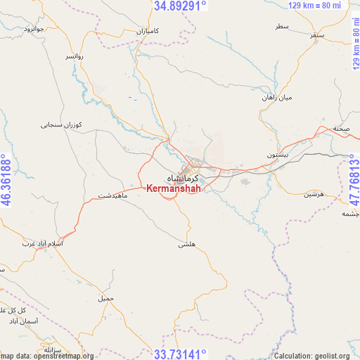
Kermanshah GPS coordinates[2]
34° 18' 51.012" North, 47° 3' 54" East
| Map corner | latitude | longitude |
|---|---|---|
| Upper-left | 34.89291°, | 46.36188° |
| Center: | 34.31417°, | 47.065° |
| Lower-right: | 33.73141°, | 47.76813° |
| Map W x H: | 129.1×129.1 km | = 80.2×80.2mi |
| max Lat: | 39.6482° ⇑50.3% North |
| Kermanshah: | 34.31417° |
| min Lat: | ⇓49.7% South 25.2919° |
| min Long | Kermanshah | max Long |
| 44.38416° | 47.065° | 61.9965° |
| W 12.5%⇐ | ⇒87.5% E |
Elevation
Elevation of Kermanshah is 1392 m = 4567 ft, and this is 343 m = 1125 ft above average elevation for this country.
| Max E: |
2564 m = 8412 ft | 35.6% |
| Kermanshah | 1392 m 4567 ft | |
| Avg. | 1049 m = 3442 ft | |
Min E: |
-24 m = -79 ft | 64.4% |
See also: Kermanshah elevation on elevation.city.
Geographical zone
Kermanshah is located in North temperate zone (between Tropic of Cancer and the Arctic Circle). Distance of this Northern Tropic circle is 1209.5 km =751.5 mi to South.| Distance of | km | miles | from Kermanshah |
|---|---|---|---|
| North Pole | 6191.7 | 3847.3 | to North |
| Arctic Circle | 3585.8 | 2228.1 | to North |
| Tropic Cancer | 1209.5 | 751.5 | to South |
| Equator | 3815.4 | 2370.8 | to South |


Nearby cities:
15 places around Kermanshah: (largest is in red/bold)
• Eslāmābād-e Gharb
54.4 km =33.8 mi,  245°
245°
• Eyvān
88.2 km =54.8 mi,  232°
232°
• Harsīn
48.1 km =29.9 mi,  95°
95°
• Javānrūd
73.4 km =45.6 mi,  316°
316°
• Javānrūd
75.9 km =47.2 mi, 316°
• Kahrīz
7.8 km =4.8 mi,  353°
353°
• Kangāvar
85.3 km =53 mi,  75°
75°
• Kerend-e Gharb
75.6 km =47 mi,  267°
267°
• Kāmyārān
54.8 km =34.1 mi, 347°
• Nūrābād
87.7 km =54.5 mi,  107°
107°
• Ravānsar
58.4 km =36.3 mi, 319°
• Sarābleh
76.2 km =47.3 mi,  217°
217°
• Sonqor
71.4 km =44.4 mi,  43°
43°
• Īlām
95.8 km =59.5 mi, 218°
• Şaḩneh
60.3 km =37.5 mi,  72°
72°
Sources, notices
• [Note1] Compared only with cities in Iran existing in our database
• [Src1] Map data: © OpenStreetMap contributors (CC-BY-SA)
• [Src2] Other city data from geonames.org with taken over terms of usage.
• [Src3] Geographical zone / Annual Mean Temperature by Robert A. Rohde @ Wikipedia
