Mehrān geodata
Mehrān (Ilam Province) is a seat of a second-order administrative division; located in Iran in Asia/Tehran (GMT+3.5) time zone. With population of 11,831 people, there are 205 cities with bigger population in this country. Compared to other cities in Iran, 60.5% of cities are located further ↑North; 93.7% of cities are located further →East and 80.5% of cities have higher elevation than Mehrān. Note1


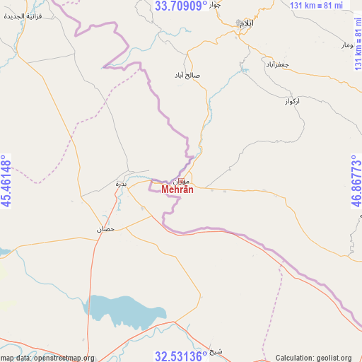
Mehrān GPS coordinates[2]
33° 7' 19.92" North, 46° 9' 52.56" East
| Map corner | latitude | longitude |
|---|---|---|
| Upper-left | 33.70909°, | 45.46148° |
| Center: | 33.1222°, | 46.1646° |
| Lower-right: | 32.53136°, | 46.86773° |
| Map W x H: | 131×131 km | = 81.4×81.4mi |
| max Lat: | 39.6482° ⇑60.5% North |
| Mehrān: | 33.1222° |
| min Lat: | ⇓39.5% South 25.2919° |
| min Long | Mehrān | max Long |
| 44.38416° | 46.1646° | 61.9965° |
| W 6.3%⇐ | ⇒93.7% E |
Elevation
Elevation of Mehrān is 150 m = 492 ft, and this is 899 m = 2949 ft below average elevation for this country.
| Max E: |
2564 m = 8412 ft | 80.5% |
| Avg. | 1049 m = 3442 ft | |
| Mehrān | 150 m = 492 ft | |
Min E: |
-24 m = -79 ft | 19.5% |
See also: Iran elevation on elevation.city.
Geographical zone
Mehrān is located in North temperate zone (between Tropic of Cancer and the Arctic Circle). Distance of this Northern Tropic circle is 1076.9 km =669.2 mi to South.| Distance of | km | miles | from Mehrān |
|---|---|---|---|
| North Pole | 6324.2 | 3929.7 | to North |
| Arctic Circle | 3718.3 | 2310.4 | to North |
| Tropic Cancer | 1076.9 | 669.2 | to South |
| Equator | 3682.8 | 2288.4 | to South |


Nearby cities:
15 places around Mehrān: (largest is in red/bold)
• Arakvāz-e Malekshāhī
49.7 km =30.9 mi,  54°
54°
• Darreh Shahr
113.2 km =70.3 mi,  88°
88°
• Dehlorān
113.5 km =70.5 mi,  114°
114°
• Eslāmābād-e Gharb
114.8 km =71.3 mi,  17°
17°
• Eyvān
79.5 km =49.4 mi,  9°
9°
• Gīlān-e Gharb
115.6 km =71.8 mi,  348°
348°
• Kahrīz
162.7 km =101.1 mi,  30°
30°
• Kerend-e Gharb
129.4 km =80.4 mi,  3°
3°
• Kermanshah
156.5 km =97.2 mi, 32°
• Kūhdasht
141.8 km =88.1 mi,  71°
71°
• Poldokhtar
143.9 km =89.4 mi, 88°
• Sarpol-e Z̄ahāb
151.5 km =94.1 mi, 349°
• Sarābleh
80.9 km =50.3 mi, 27°
• Ābdānān
117.9 km =73.3 mi,  97°
97°
• Īlām
62.1 km =38.6 mi, 22°
Sources, notices
• [Note1] Compared only with cities in Iran existing in our database
• [Src1] Map data: © OpenStreetMap contributors (CC-BY-SA)
• [Src2] Other city data from geonames.org with taken over terms of usage.
• [Src3] Geographical zone / Annual Mean Temperature by Robert A. Rohde @ Wikipedia
