Rūdsar geodata
Rūdsar (Gīlān) is a seat of a second-order administrative division; located in Iran in Asia/Tehran (GMT+3.5) time zone. With population of 47,502 people, there are 136 cities with bigger population in this country. Compared to other cities in Iran, 85.3% of cities are located further ↓South; 59.6% of cities are located further →East and 95.9% of cities have higher elevation than Rūdsar. Note1


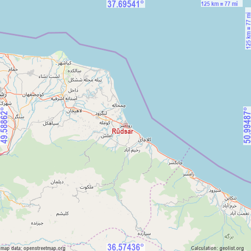
Rūdsar GPS coordinates[2]
37° 8' 13.056" North, 50° 17' 30.264" East
| Map corner | latitude | longitude |
|---|---|---|
| Upper-left | 37.69541°, | 49.58862° |
| Center: | 37.13696°, | 50.29174° |
| Lower-right: | 36.57436°, | 50.99487° |
| Map W x H: | 124.6×124.6 km | = 77.4×77.4mi |
| max Lat: | 39.6482° ⇑14.7% North |
| Rūdsar: | 37.13696° |
| min Lat: | ⇓85.3% South 25.2919° |
| min Long | Rūdsar | max Long |
| 44.38416° | 50.29174° | 61.9965° |
| W 40.4%⇐ | ⇒59.6% E |
Elevation
Elevation of Rūdsar is -1 m = -3 ft, and this is 1050 m = 3445 ft below average elevation for this country.
| Max E: |
2564 m = 8412 ft | 95.9% |
| Avg. | 1049 m = 3442 ft | |
| Rūdsar | -1 m = -3 ft | |
Min E: |
-24 m = -79 ft | 4.1% |
See also: Rūdsar elevation on elevation.city.
Geographical zone
Rūdsar is located in North temperate zone (between Tropic of Cancer and the Arctic Circle). Distance of this Northern Tropic circle is 1523.3 km =946.5 mi to South.| Distance of | km | miles | from Rūdsar |
|---|---|---|---|
| North Pole | 5877.8 | 3652.3 | to North |
| Arctic Circle | 3271.9 | 2033.1 | to North |
| Tropic Cancer | 1523.3 | 946.5 | to South |
| Equator | 4129.2 | 2565.8 | to South |


Nearby cities:
15 places around Rūdsar: (largest is in red/bold)
• Amlash
10.3 km =6.4 mi,  244°
244°
• Bandar-e Anzalī
82.7 km =51.4 mi,  296°
296°
• Fūman
87.3 km =54.2 mi,  276°
276°
• Langarūd
13.9 km =8.6 mi, 297°
• Lāhījān
26.1 km =16.2 mi,  286°
286°
• Nashtārūd
77.9 km =48.4 mi,  123°
123°
• Pā’īn-e Bāzār-e Rūdbār
84.5 km =52.5 mi,  245°
245°
• Rasht
64.2 km =39.9 mi, 283°
• Rāmsar
39.9 km =24.8 mi,  127°
127°
• Shaft
79.1 km =49.2 mi,  272°
272°
• Sīāhkal
37.3 km =23.2 mi, 272°
• Tonekābon
62.8 km =39 mi, 124°
• Āstāneh-ye Ashrafīyeh
33.9 km =21.1 mi, 294°
• Şowme‘eh Sarā
88.4 km =54.9 mi, 281°
• ‘Abbāsābād
85.5 km =53.1 mi, 122°
Sources, notices
• [Note1] Compared only with cities in Iran existing in our database
• [Src1] Map data: © OpenStreetMap contributors (CC-BY-SA)
• [Src2] Other city data from geonames.org with taken over terms of usage.
• [Src3] Geographical zone / Annual Mean Temperature by Robert A. Rohde @ Wikipedia
