Kangāvar geodata
Kangāvar (Kermānshāh) is a seat of a second-order administrative division; located in Iran in Asia/Tehran (GMT+3.5) time zone. With population of 53,414 people, there are 118 cities with bigger population in this country. Compared to other cities in Iran, 51.2% of cities are located further ↓South; 82.8% of cities are located further →East and 69.2% of cities have lower elevation than Kangāvar. Note1


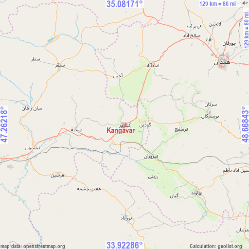
Kangāvar GPS coordinates[2]
34° 30' 15.48" North, 47° 57' 55.08" East
| Map corner | latitude | longitude |
|---|---|---|
| Upper-left | 35.08171°, | 47.26218° |
| Center: | 34.5043°, | 47.9653° |
| Lower-right: | 33.92286°, | 48.66843° |
| Map W x H: | 128.9×128.9 km | = 80.1×80.1mi |
| max Lat: | 39.6482° ⇑48.8% North |
| Kangāvar: | 34.5043° |
| min Lat: | ⇓51.2% South 25.2919° |
| min Long | Kangāvar | max Long |
| 44.38416° | 47.9653° | 61.9965° |
| W 17.2%⇐ | ⇒82.8% E |
Elevation
Elevation of Kangāvar is 1476 m = 4843 ft, and this is 427 m = 1401 ft above average elevation for this country.
| Max E: |
2564 m = 8412 ft | 30.8% |
| Kangāvar | 1476 m 4843 ft | |
| Avg. | 1049 m = 3442 ft | |
Min E: |
-24 m = -79 ft | 69.2% |
See also: Kangāvar elevation on elevation.city.
Geographical zone
Kangāvar is located in North temperate zone (between Tropic of Cancer and the Arctic Circle). Distance of this Northern Tropic circle is 1230.6 km =764.7 mi to South.| Distance of | km | miles | from Kangāvar |
|---|---|---|---|
| North Pole | 6170.5 | 3834.2 | to North |
| Arctic Circle | 3564.7 | 2215 | to North |
| Tropic Cancer | 1230.6 | 764.7 | to South |
| Equator | 3836.5 | 2383.9 | to South |


Nearby cities:
15 places around Kangāvar: (largest is in red/bold)
• Anūch
71.1 km =44.2 mi,  128°
128°
• Asadābād
34 km =21.1 mi,  24°
24°
• Bahār
62.5 km =38.8 mi,  44°
44°
• Famast
69 km =42.9 mi,  138°
138°
• Hamadān
60 km =37.3 mi,  56°
56°
• Harsīn
43.3 km =26.9 mi,  233°
233°
• Nahāvand
51.2 km =31.8 mi, 132°
• Nūrābād
47.9 km =29.8 mi,  179°
179°
• Pasragad Branch
55.4 km =34.4 mi, 56°
• Qorveh
75 km =46.6 mi,  348°
348°
• Sonqor
45.5 km =28.3 mi,  312°
312°
• Tūyserkān
44.1 km =27.4 mi,  83°
83°
• pamas
69.1 km =42.9 mi, 138°
• Āzādshahr
63.8 km =39.6 mi, 60°
• Şaḩneh
25.3 km =15.7 mi,  264°
264°
Sources, notices
• [Note1] Compared only with cities in Iran existing in our database
• [Src1] Map data: © OpenStreetMap contributors (CC-BY-SA)
• [Src2] Other city data from geonames.org with taken over terms of usage.
• [Src3] Geographical zone / Annual Mean Temperature by Robert A. Rohde @ Wikipedia
