Nūrābād geodata
Nūrābād (Lorestān) is a seat of a second-order administrative division; located in Iran in Asia/Tehran (GMT+3.5) time zone. With population of 73,528 people, there are 90 cities with bigger population in this country. Compared to other cities in Iran, 52.4% of cities are located further ↑North; 82.5% of cities are located further →East and 85.5% of cities have lower elevation than Nūrābād. Note1


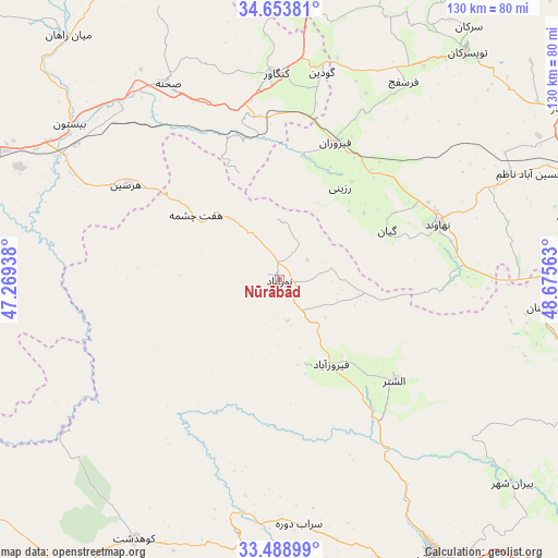
Nūrābād GPS coordinates[2]
34° 4' 24.24" North, 47° 58' 21" East
| Map corner | latitude | longitude |
|---|---|---|
| Upper-left | 34.65381°, | 47.26938° |
| Center: | 34.0734°, | 47.9725° |
| Lower-right: | 33.48899°, | 48.67563° |
| Map W x H: | 129.5×129.5 km | = 80.5×80.5mi |
| max Lat: | 39.6482° ⇑52.4% North |
| Nūrābād: | 34.0734° |
| min Lat: | ⇓47.6% South 25.2919° |
| min Long | Nūrābād | max Long |
| 44.38416° | 47.9725° | 61.9965° |
| W 17.5%⇐ | ⇒82.5% E |
Elevation
Elevation of Nūrābād is 1790 m = 5873 ft, and this is 741 m = 2431 ft above average elevation for this country.
| Max E: |
2564 m = 8412 ft | 14.5% |
| Nūrābād | 1790 m 5873 ft | |
| Avg. | 1049 m = 3442 ft | |
Min E: |
-24 m = -79 ft | 85.5% |
See also: Nūrābād elevation on elevation.city.
Geographical zone
Nūrābād is located in North temperate zone (between Tropic of Cancer and the Arctic Circle). Distance of this Northern Tropic circle is 1182.7 km =734.9 mi to South.| Distance of | km | miles | from Nūrābād |
|---|---|---|---|
| North Pole | 6218.5 | 3864 | to North |
| Arctic Circle | 3612.6 | 2244.8 | to North |
| Tropic Cancer | 1182.7 | 734.9 | to South |
| Equator | 3788.6 | 2354.1 | to South |


Nearby cities:
15 places around Nūrābād: (largest is in red/bold)
• Aleshtar
35.4 km =22 mi,  131°
131°
• Anūch
55.5 km =34.5 mi,  85°
85°
• Asadābād
80 km =49.7 mi,  9°
9°
• Borūjerd
74.5 km =46.3 mi,  105°
105°
• Famast
45.3 km =28.1 mi, 94°
• Harsīn
41.9 km =26 mi,  301°
301°
• Kangāvar
47.9 km =29.8 mi,  359°
359°
• Khorramabad
74.1 km =46 mi,  151°
151°
• Kūhdasht
68.8 km =42.8 mi,  209°
209°
• Nahāvand
39.2 km =24.4 mi,  70°
70°
• Sarāb-e Dūreh
56.8 km =35.3 mi,  175°
175°
• Tūyserkān
68.5 km =42.6 mi,  39°
39°
• Vasīān
65.2 km =40.5 mi,  173°
173°
• pamas
45.3 km =28.1 mi,  95°
95°
• Şaḩneh
52.2 km =32.4 mi,  330°
330°
Sources, notices
• [Note1] Compared only with cities in Iran existing in our database
• [Src1] Map data: © OpenStreetMap contributors (CC-BY-SA)
• [Src2] Other city data from geonames.org with taken over terms of usage.
• [Src3] Geographical zone / Annual Mean Temperature by Robert A. Rohde @ Wikipedia
