Shahrud geodata
Shahrud (Semnan) is a populated place; located in Iran in Asia/Tehran (GMT+3.5) time zone. With population of 131,889 people, there are 53 cities with bigger population in this country. Compared to other cities in Iran, 73.2% of cities are located further ↓South; 76.4% of cities are located further ←West and 61.5% of cities have lower elevation than Shahrud. Note1


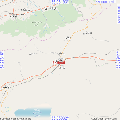
Shahrud GPS coordinates[2]
36° 25' 5.484" North, 54° 58' 34.608" East
| Map corner | latitude | longitude |
|---|---|---|
| Upper-left | 36.98193°, | 54.27316° |
| Center: | 36.41819°, | 54.97628° |
| Lower-right: | 35.85032°, | 55.67941° |
| Map W x H: | 125.8×125.8 km | = 78.2×78.2mi |
| max Lat: | 39.6482° ⇑26.8% North |
| Shahrud: | 36.41819° |
| min Lat: | ⇓73.2% South 25.2919° |
| min Long | Shahrud | max Long |
| 44.38416° | 54.97628° | 61.9965° |
| W 76.4%⇐ | ⇒23.6% E |
Elevation
Elevation of Shahrud is 1351 m = 4432 ft, and this is 302 m = 991 ft above average elevation for this country.
| Max E: |
2564 m = 8412 ft | 38.5% |
| Shahrud | 1351 m 4432 ft | |
| Avg. | 1049 m = 3442 ft | |
Min E: |
-24 m = -79 ft | 61.5% |
See also: Shahrud elevation on elevation.city.
Geographical zone
Shahrud is located in North temperate zone (between Tropic of Cancer and the Arctic Circle). Distance of this Northern Tropic circle is 1443.4 km =896.9 mi to South.| Distance of | km | miles | from Shahrud |
|---|---|---|---|
| North Pole | 5957.7 | 3701.9 | to North |
| Arctic Circle | 3351.9 | 2082.8 | to North |
| Tropic Cancer | 1443.4 | 896.9 | to South |
| Equator | 4049.3 | 2516.1 | to South |


Nearby cities:
15 places around Shahrud: (largest is in red/bold)
• Aliabad-e Katul
55.6 km =34.5 mi,  349°
349°
• Bandar-e Gaz
100 km =62.1 mi,  293°
293°
• Bandar-e Torkaman
96.9 km =60.2 mi,  303°
303°
• Dāmghān
63.2 km =39.3 mi,  243°
243°
• Gomīshān
108.2 km =67.2 mi,  312°
312°
• Gonbad-e Kāvūs
94 km =58.4 mi,  10°
10°
• Gorgān
67 km =41.6 mi, 314°
• Gālīkesh
103.4 km =64.2 mi,  23°
23°
• Kord Kūy
87.7 km =54.5 mi, 298°
• Mīnūdasht
96.9 km =60.2 mi, 21°
• Qarnābād
56.5 km =35.1 mi,  322°
322°
• Rāmīān
68.1 km =42.3 mi, 12°
• Āq Qalā
80.9 km =50.3 mi, 324°
• Āq Qāyeh
96.6 km =60 mi, 9°
• Āzādshahr
76.3 km =47.4 mi, 13°
Sources, notices
• [Note1] Compared only with cities in Iran existing in our database
• [Src1] Map data: © OpenStreetMap contributors (CC-BY-SA)
• [Src2] Other city data from geonames.org with taken over terms of usage.
• [Src3] Geographical zone / Annual Mean Temperature by Robert A. Rohde @ Wikipedia
