Bojnūrd geodata
Bojnūrd (North Khorasan) is a seat of a first-order administrative division; located in Iran in Asia/Tehran (GMT+3.5) time zone. With population of 192,041 people, there are 41 cities with bigger population in this country. Compared to other cities in Iran, 91.2% of cities are located further ↓South; 85% of cities are located further ←West and 54.6% of cities have higher elevation than Bojnūrd. Note1


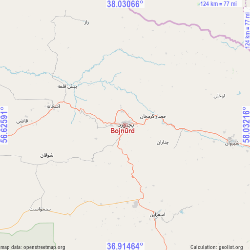
Bojnūrd GPS coordinates[2]
37° 28' 29.028" North, 57° 19' 44.508" East
| Map corner | latitude | longitude |
|---|---|---|
| Upper-left | 38.03066°, | 56.62591° |
| Center: | 37.47473°, | 57.32903° |
| Lower-right: | 36.91464°, | 58.03216° |
| Map W x H: | 124.1×124.1 km | = 77.1×77.1mi |
| max Lat: | 39.6482° ⇑8.8% North |
| Bojnūrd: | 37.47473° |
| min Lat: | ⇓91.2% South 25.2919° |
| min Long | Bojnūrd | max Long |
| 44.38416° | 57.32903° | 61.9965° |
| W 85%⇐ | ⇒15% E |
Elevation
Elevation of Bojnūrd is 1069 m = 3507 ft, and this is 20 m = 66 ft above average elevation for this country.
| Max E: |
2564 m = 8412 ft | 54.6% |
| Bojnūrd | 1069 m 3507 ft | |
| Avg. | 1049 m = 3442 ft | |
Min E: |
-24 m = -79 ft | 45.4% |
See also: Bojnūrd elevation on elevation.city.
Geographical zone
Bojnūrd is located in North temperate zone (between Tropic of Cancer and the Arctic Circle). Distance of this Northern Tropic circle is 1560.9 km =969.9 mi to South.| Distance of | km | miles | from Bojnūrd |
|---|---|---|---|
| North Pole | 5840.3 | 3629 | to North |
| Arctic Circle | 3234.4 | 2009.8 | to North |
| Tropic Cancer | 1560.9 | 969.9 | to South |
| Equator | 4166.8 | 2589.1 | to South |


Nearby cities:
15 places around Bojnūrd: (largest is in red/bold)
• Dargaz
157.1 km =97.6 mi,  91°
91°
• Esfarāyen
47.1 km =29.3 mi,  160°
160°
• Fārūj
83.2 km =51.7 mi,  108°
108°
• Garmeh
106.8 km =66.4 mi,  239°
239°
• Gālīkesh
169 km =105 mi,  262°
262°
• Joghtāy
96 km =59.7 mi,  193°
193°
• Jājarm
102.3 km =63.6 mi, 235°
• Kalāleh
162.5 km =101 mi,  266°
266°
• Marāveh Tappeh
129.9 km =80.7 mi,  291°
291°
• Neqāb
85.7 km =53.3 mi,  174°
174°
• Qūchān
112.2 km =69.7 mi, 111°
• Sabzevar
143.8 km =89.4 mi, 167°
• Shīrvān
53.7 km =33.4 mi,  99°
99°
• Solţānābād
134.8 km =83.8 mi,  152°
152°
• Āshkhāneh
37.2 km =23.1 mi, 285°
Sources, notices
• [Note1] Compared only with cities in Iran existing in our database
• [Src1] Map data: © OpenStreetMap contributors (CC-BY-SA)
• [Src2] Other city data from geonames.org with taken over terms of usage.
• [Src3] Geographical zone / Annual Mean Temperature by Robert A. Rohde @ Wikipedia
