Kalāleh geodata
Kalāleh (Golestan) is a seat of a second-order administrative division; located in Iran in Asia/Tehran (GMT+3.5) time zone. With population of 33,700 people, there are 167 cities with bigger population in this country. Compared to other cities in Iran, 89.6% of cities are located further ↓South; 78.9% of cities are located further ←West and 80% of cities have higher elevation than Kalāleh. Note1


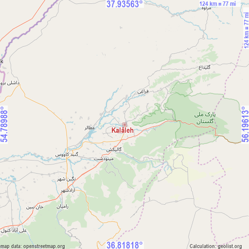
Kalāleh GPS coordinates[2]
37° 22' 44.364" North, 55° 29' 34.8" East
| Map corner | latitude | longitude |
|---|---|---|
| Upper-left | 37.93563°, | 54.78988° |
| Center: | 37.37899°, | 55.493° |
| Lower-right: | 36.81818°, | 56.19613° |
| Map W x H: | 124.2×124.2 km | = 77.2×77.2mi |
| max Lat: | 39.6482° ⇑10.4% North |
| Kalāleh: | 37.37899° |
| min Lat: | ⇓89.6% South 25.2919° |
| min Long | Kalāleh | max Long |
| 44.38416° | 55.493° | 61.9965° |
| W 78.9%⇐ | ⇒21.1% E |
Elevation
Elevation of Kalāleh is 152 m = 499 ft, and this is 897 m = 2943 ft below average elevation for this country.
| Max E: |
2564 m = 8412 ft | 80% |
| Avg. | 1049 m = 3442 ft | |
| Kalāleh | 152 m = 499 ft | |
Min E: |
-24 m = -79 ft | 20% |
See also: Iran elevation on elevation.city.
Geographical zone
Kalāleh is located in North temperate zone (between Tropic of Cancer and the Arctic Circle). Distance of this Northern Tropic circle is 1550.2 km =963.2 mi to South.| Distance of | km | miles | from Kalāleh |
|---|---|---|---|
| North Pole | 5850.9 | 3635.6 | to North |
| Arctic Circle | 3245 | 2016.3 | to North |
| Tropic Cancer | 1550.2 | 963.2 | to South |
| Equator | 4156.2 | 2582.5 | to South |


Nearby cities:
15 places around Kalāleh: (largest is in red/bold)
• Aliabad-e Katul
76.1 km =47.3 mi,  226°
226°
• Garmeh
82.9 km =51.5 mi,  121°
121°
• Gonbad-e Kāvūs
32.2 km =20 mi,  243°
243°
• Gorgān
110.5 km =68.7 mi, 237°
• Gālīkesh
12.9 km =8 mi,  203°
203°
• Jājarm
91.9 km =57.1 mi, 121°
• Marāveh Tappeh
71.2 km =44.2 mi,  34°
34°
• Mīnūdasht
19.7 km =12.2 mi,  212°
212°
• Qarnābād
101.1 km =62.8 mi, 232°
• Rāmīān
51 km =31.7 mi,  217°
217°
• Shahrud
116.3 km =72.3 mi, 203°
• Āq Qalā
100.5 km =62.4 mi,  246°
246°
• Āq Qāyeh
31.7 km =19.7 mi, 248°
• Āshkhāneh
127.7 km =79.3 mi,  80°
80°
• Āzādshahr
43.2 km =26.8 mi, 221°
Sources, notices
• [Note1] Compared only with cities in Iran existing in our database
• [Src1] Map data: © OpenStreetMap contributors (CC-BY-SA)
• [Src2] Other city data from geonames.org with taken over terms of usage.
• [Src3] Geographical zone / Annual Mean Temperature by Robert A. Rohde @ Wikipedia
