Āshkhāneh geodata
Āshkhāneh (North Khorasan) is a seat of a second-order administrative division; located in Iran in Asia/Tehran (GMT+3.5) time zone. In our database, there are 232 cities with bigger population. Compared to other cities in Iran, 92.3% of cities are located further ↓South; 83.4% of cities are located further ←West and 68.3% of cities have higher elevation than Āshkhāneh. Note1


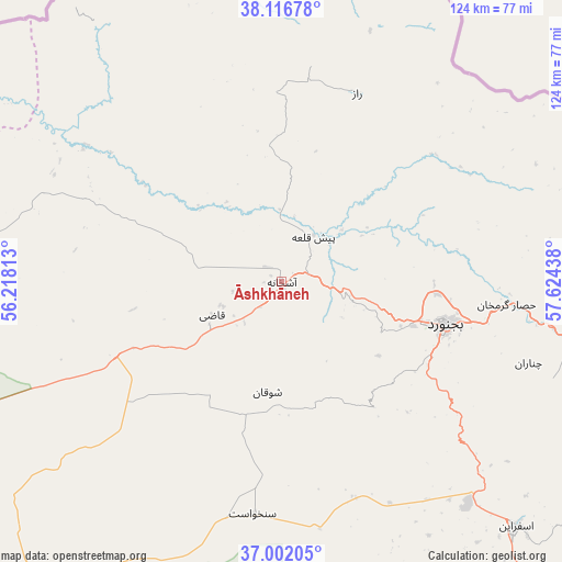
Āshkhāneh GPS coordinates[2]
37° 33' 41.4" North, 56° 55' 16.5" East
| Map corner | latitude | longitude |
|---|---|---|
| Upper-left | 38.11678°, | 56.21813° |
| Center: | 37.5615°, | 56.92125° |
| Lower-right: | 37.00205°, | 57.62438° |
| Map W x H: | 123.9×123.9 km | = 77×77mi |
| max Lat: | 39.6482° ⇑7.7% North |
| Āshkhāneh: | 37.5615° |
| min Lat: | ⇓92.3% South 25.2919° |
| min Long | Āshkhāneh | max Long |
| 44.38416° | 56.92125° | 61.9965° |
| W 83.4%⇐ | ⇒16.6% E |
Elevation
Elevation of Āshkhāneh is 743 m = 2438 ft, and this is 306 m = 1004 ft below average elevation for this country.
| Max E: |
2564 m = 8412 ft | 68.3% |
| Avg. | 1049 m = 3442 ft | |
| Āshkhāneh | 743 m = 2438 ft | |
Min E: |
-24 m = -79 ft | 31.7% |
See also: Iran elevation on elevation.city.
Geographical zone
Āshkhāneh is located in North temperate zone (between Tropic of Cancer and the Arctic Circle). Distance of this Northern Tropic circle is 1570.5 km =975.9 mi to South.| Distance of | km | miles | from Āshkhāneh |
|---|---|---|---|
| North Pole | 5830.6 | 3623 | to North |
| Arctic Circle | 3224.7 | 2003.7 | to North |
| Tropic Cancer | 1570.5 | 975.9 | to South |
| Equator | 4176.4 | 2595.1 | to South |


Nearby cities:
15 places around Āshkhāneh: (largest is in red/bold)
• Bojnūrd
37.2 km =23.1 mi,  105°
105°
• Esfarāyen
75 km =46.6 mi,  136°
136°
• Fārūj
120.4 km =74.8 mi, 107°
• Garmeh
84.9 km =52.8 mi,  221°
221°
• Gonbad-e Kāvūs
158.7 km =98.6 mi,  257°
257°
• Gālīkesh
135.2 km =84 mi, 256°
• Joghtāy
103.8 km =64.5 mi,  172°
172°
• Jājarm
83.2 km =51.7 mi, 215°
• Kalāleh
127.7 km =79.3 mi, 260°
• Marāveh Tappeh
93 km =57.8 mi,  294°
294°
• Mīnūdasht
141.7 km =88 mi,  254°
254°
• Neqāb
104.8 km =65.1 mi,  154°
154°
• Qūchān
149.3 km =92.8 mi, 109°
• Shīrvān
90.8 km =56.4 mi,  101°
101°
• Āq Qāyeh
158.9 km =98.7 mi, 258°
Sources, notices
• [Note1] Compared only with cities in Iran existing in our database
• [Src1] Map data: © OpenStreetMap contributors (CC-BY-SA)
• [Src2] Other city data from geonames.org with taken over terms of usage.
• [Src3] Geographical zone / Annual Mean Temperature by Robert A. Rohde @ Wikipedia
