Marāveh Tappeh geodata
Marāveh Tappeh (Golestan) is a seat of a second-order administrative division; located in Iran in Asia/Tehran (GMT+3.5) time zone. In our database, there are 232 cities with bigger population. Compared to other cities in Iran, 93.9% of cities are located further ↓South; 79.8% of cities are located further ←West and 78.7% of cities have higher elevation than Marāveh Tappeh. Note1


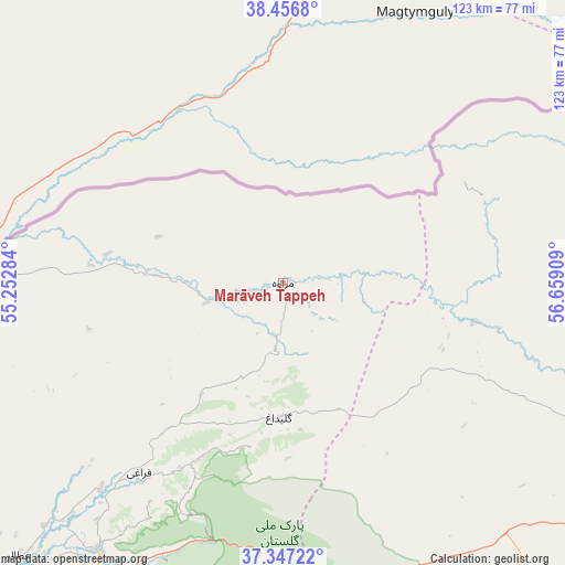
Marāveh Tappeh GPS coordinates[2]
37° 54' 14.76" North, 55° 57' 21.456" East
| Map corner | latitude | longitude |
|---|---|---|
| Upper-left | 38.4568°, | 55.25284° |
| Center: | 37.9041°, | 55.95596° |
| Lower-right: | 37.34722°, | 56.65909° |
| Map W x H: | 123.4×123.4 km | = 76.7×76.7mi |
| max Lat: | 39.6482° ⇑6.1% North |
| Marāveh Tappeh: | 37.9041° |
| min Lat: | ⇓93.9% South 25.2919° |
| min Long | Marāveh Tappeh | max Long |
| 44.38416° | 55.95596° | 61.9965° |
| W 79.8%⇐ | ⇒20.2% E |
Elevation
Elevation of Marāveh Tappeh is 210 m = 689 ft, and this is 839 m = 2753 ft below average elevation for this country.
| Max E: |
2564 m = 8412 ft | 78.7% |
| Avg. | 1049 m = 3442 ft | |
| Marāveh Tappeh | 210 m = 689 ft | |
Min E: |
-24 m = -79 ft | 21.3% |
See also: Iran elevation on elevation.city.
Geographical zone
Marāveh Tappeh is located in North temperate zone (between Tropic of Cancer and the Arctic Circle). Distance of this Northern Tropic circle is 1608.6 km =999.5 mi to South.| Distance of | km | miles | from Marāveh Tappeh |
|---|---|---|---|
| North Pole | 5792.5 | 3599.3 | to North |
| Arctic Circle | 3186.6 | 1980.1 | to North |
| Tropic Cancer | 1608.6 | 999.5 | to South |
| Equator | 4214.5 | 2618.8 | to South |


Nearby cities:
15 places around Marāveh Tappeh: (largest is in red/bold)
• Aliabad-e Katul
146.5 km =91 mi,  221°
221°
• Bojnūrd
129.9 km =80.7 mi,  111°
111°
• Esfarāyen
165.1 km =102.6 mi,  123°
123°
• Garmeh
106.1 km =65.9 mi,  163°
163°
• Gonbad-e Kāvūs
100.6 km =62.5 mi, 223°
• Gālīkesh
83.9 km =52.1 mi,  213°
213°
• Jājarm
112.5 km =69.9 mi, 160°
• Kalāleh
71.2 km =44.2 mi, 214°
• Mīnūdasht
90.9 km =56.5 mi, 214°
• Qarnābād
170.3 km =105.8 mi,  225°
225°
• Rāmīān
122.2 km =75.9 mi, 216°
• Āq Qalā
165.4 km =102.8 mi, 233°
• Āq Qāyeh
99.1 km =61.6 mi, 225°
• Āshkhāneh
93 km =57.8 mi, 114°
• Āzādshahr
114.2 km =71 mi, 217°
Sources, notices
• [Note1] Compared only with cities in Iran existing in our database
• [Src1] Map data: © OpenStreetMap contributors (CC-BY-SA)
• [Src2] Other city data from geonames.org with taken over terms of usage.
• [Src3] Geographical zone / Annual Mean Temperature by Robert A. Rohde @ Wikipedia
