Neqāb geodata
Neqāb (Razavi Khorasan) is a seat of a second-order administrative division; located in Iran in Asia/Tehran (GMT+3.5) time zone. In our database, there are 232 cities with bigger population. Compared to other cities in Iran, 78.5% of cities are located further ↓South; 85.3% of cities are located further ←West and 54.2% of cities have higher elevation than Neqāb. Note1


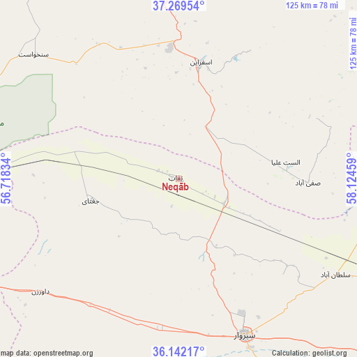
Neqāb GPS coordinates[2]
36° 42' 28.512" North, 57° 25' 17.256" East
| Map corner | latitude | longitude |
|---|---|---|
| Upper-left | 37.26954°, | 56.71834° |
| Center: | 36.70792°, | 57.42146° |
| Lower-right: | 36.14217°, | 58.12459° |
| Map W x H: | 125.4×125.4 km | = 77.9×77.9mi |
| max Lat: | 39.6482° ⇑21.5% North |
| Neqāb: | 36.70792° |
| min Lat: | ⇓78.5% South 25.2919° |
| min Long | Neqāb | max Long |
| 44.38416° | 57.42146° | 61.9965° |
| W 85.3%⇐ | ⇒14.7% E |
Elevation
Elevation of Neqāb is 1073 m = 3520 ft, and this is 24 m = 79 ft above average elevation for this country.
| Max E: |
2564 m = 8412 ft | 54.2% |
| Neqāb | 1073 m 3520 ft | |
| Avg. | 1049 m = 3442 ft | |
Min E: |
-24 m = -79 ft | 45.8% |
See also: Iran elevation on elevation.city.
Geographical zone
Neqāb is located in North temperate zone (between Tropic of Cancer and the Arctic Circle). Distance of this Northern Tropic circle is 1475.6 km =916.9 mi to South.| Distance of | km | miles | from Neqāb |
|---|---|---|---|
| North Pole | 5925.5 | 3681.9 | to North |
| Arctic Circle | 3319.6 | 2062.7 | to North |
| Tropic Cancer | 1475.6 | 916.9 | to South |
| Equator | 4081.5 | 2536.1 | to South |


Nearby cities:
15 places around Neqāb: (largest is in red/bold)
• Bardaskan
168.2 km =104.5 mi,  162°
162°
• Bojnūrd
85.7 km =53.3 mi,  354°
354°
• Bozghān
114.1 km =70.9 mi,  114°
114°
• Chenārān
151.7 km =94.3 mi,  92°
92°
• Esfarāyen
41.7 km =25.9 mi,  10°
10°
• Fārūj
91.7 km =57 mi,  50°
50°
• Garmeh
105.4 km =65.5 mi,  287°
287°
• Joghtāy
32.1 km =19.9 mi,  255°
255°
• Jājarm
96.5 km =60 mi, 286°
• Neyshābūr
134.6 km =83.6 mi, 114°
• Qūchān
106.4 km =66.1 mi,  65°
65°
• Sabzevar
59.8 km =37.2 mi, 157°
• Shīrvān
88.9 km =55.2 mi,  30°
30°
• Solţānābād
64.7 km =40.2 mi,  121°
121°
• Āshkhāneh
104.8 km =65.1 mi,  334°
334°
Sources, notices
• [Note1] Compared only with cities in Iran existing in our database
• [Src1] Map data: © OpenStreetMap contributors (CC-BY-SA)
• [Src2] Other city data from geonames.org with taken over terms of usage.
• [Src3] Geographical zone / Annual Mean Temperature by Robert A. Rohde @ Wikipedia
