Esfarāyen geodata
Esfarāyen (North Khorasan) is a seat of a second-order administrative division; located in Iran in Asia/Tehran (GMT+3.5) time zone. With population of 59,678 people, there are 106 cities with bigger population in this country. Compared to other cities in Iran, 84.4% of cities are located further ↓South; 85.9% of cities are located further ←West and 54.6% of cities have lower elevation than Esfarāyen. Note1


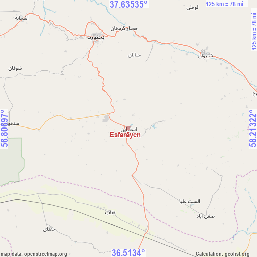
Esfarāyen GPS coordinates[2]
37° 4' 35.22" North, 57° 30' 36.324" East
| Map corner | latitude | longitude |
|---|---|---|
| Upper-left | 37.63535°, | 56.80697° |
| Center: | 37.07645°, | 57.51009° |
| Lower-right: | 36.5134°, | 58.21322° |
| Map W x H: | 124.7×124.7 km | = 77.5×77.5mi |
| max Lat: | 39.6482° ⇑15.6% North |
| Esfarāyen: | 37.07645° |
| min Lat: | ⇓84.4% South 25.2919° |
| min Long | Esfarāyen | max Long |
| 44.38416° | 57.51009° | 61.9965° |
| W 85.9%⇐ | ⇒14.1% E |
Elevation
Elevation of Esfarāyen is 1253 m = 4111 ft, and this is 204 m = 669 ft above average elevation for this country.
| Max E: |
2564 m = 8412 ft | 45.4% |
| Esfarāyen | 1253 m 4111 ft | |
| Avg. | 1049 m = 3442 ft | |
Min E: |
-24 m = -79 ft | 54.6% |
See also: Esfarāyen elevation on elevation.city.
Geographical zone
Esfarāyen is located in North temperate zone (between Tropic of Cancer and the Arctic Circle). Distance of this Northern Tropic circle is 1516.6 km =942.4 mi to South.| Distance of | km | miles | from Esfarāyen |
|---|---|---|---|
| North Pole | 5884.5 | 3656.5 | to North |
| Arctic Circle | 3278.7 | 2037.3 | to North |
| Tropic Cancer | 1516.6 | 942.4 | to South |
| Equator | 4122.5 | 2561.6 | to South |


Nearby cities:
15 places around Esfarāyen: (largest is in red/bold)
• Bojnūrd
47.1 km =29.3 mi,  340°
340°
• Bozghān
130.1 km =80.8 mi,  132°
132°
• Chenārān
151.1 km =93.9 mi,  108°
108°
• Dargaz
147.2 km =91.5 mi,  73°
73°
• Fārūj
65.1 km =40.5 mi, 74°
• Garmeh
108.8 km =67.6 mi,  264°
264°
• Joghtāy
62.5 km =38.8 mi,  218°
218°
• Jājarm
101.3 km =62.9 mi, 262°
• Neqāb
41.7 km =25.9 mi,  190°
190°
• Neyshābūr
149.6 km =93 mi, 129°
• Qūchān
88.7 km =55.1 mi,  87°
87°
• Sabzevar
97.3 km =60.5 mi,  170°
170°
• Shīrvān
51.4 km =31.9 mi,  46°
46°
• Solţānābād
88.4 km =54.9 mi,  147°
147°
• Āshkhāneh
75 km =46.6 mi,  316°
316°
Sources, notices
• [Note1] Compared only with cities in Iran existing in our database
• [Src1] Map data: © OpenStreetMap contributors (CC-BY-SA)
• [Src2] Other city data from geonames.org with taken over terms of usage.
• [Src3] Geographical zone / Annual Mean Temperature by Robert A. Rohde @ Wikipedia
