Bāgh-e Malek geodata
Bāgh-e Malek (Khuzestan) is a seat of a second-order administrative division; located in Iran in Asia/Tehran (GMT+3.5) time zone. In our database, there are 232 cities with bigger population. Compared to other cities in Iran, 72.6% of cities are located further ↑North; 63.5% of cities are located further →East and 69.2% of cities have higher elevation than Bāgh-e Malek. Note1


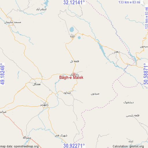
Bāgh-e Malek GPS coordinates[2]
31° 31' 26.328" North, 49° 53' 8.088" East
| Map corner | latitude | longitude |
|---|---|---|
| Upper-left | 32.12141°, | 49.18246° |
| Center: | 31.52398°, | 49.88558° |
| Lower-right: | 30.92271°, | 50.58871° |
| Map W x H: | 133.3×133.3 km | = 82.8×82.8mi |
| max Lat: | 39.6482° ⇑72.6% North |
| Bāgh-e Malek: | 31.52398° |
| min Lat: | ⇓27.4% South 25.2919° |
| min Long | Bāgh-e Malek | max Long |
| 44.38416° | 49.88558° | 61.9965° |
| W 36.5%⇐ | ⇒63.5% E |
Elevation
Elevation of Bāgh-e Malek is 711 m = 2333 ft, and this is 338 m = 1109 ft below average elevation for this country.
| Max E: |
2564 m = 8412 ft | 69.2% |
| Avg. | 1049 m = 3442 ft | |
| Bāgh-e Malek | 711 m = 2333 ft | |
Min E: |
-24 m = -79 ft | 30.8% |
See also: Iran elevation on elevation.city.
Geographical zone
Bāgh-e Malek is located in North temperate zone (between Tropic of Cancer and the Arctic Circle). Distance of this Northern Tropic circle is 899.2 km =558.7 mi to South.| Distance of | km | miles | from Bāgh-e Malek |
|---|---|---|---|
| North Pole | 6501.9 | 4040.1 | to North |
| Arctic Circle | 3896 | 2420.9 | to North |
| Tropic Cancer | 899.2 | 558.7 | to South |
| Equator | 3505.1 | 2178 | to South |


Nearby cities:
15 places around Bāgh-e Malek: (largest is in red/bold)
• Aghajari
91.7 km =57 mi,  183°
183°
• Ardal
90.5 km =56.2 mi,  54°
54°
• Dehdasht
103.7 km =64.4 mi,  141°
141°
• Fārsān
103.5 km =64.3 mi,  38°
38°
• Haftkel
34.8 km =21.6 mi,  255°
255°
• Lordegān
89.2 km =55.4 mi,  90°
90°
• Līkak
72.7 km =45.2 mi,  164°
164°
• Masjed Soleymān
71.6 km =44.5 mi,  309°
309°
• Mollās̄ānī
95 km =59 mi,  274°
274°
• Omīdīyeh
86.4 km =53.7 mi,  191°
191°
• Qal‘eh-ye Khvājeh
86.5 km =53.7 mi,  331°
331°
• Rāmhormoz
38.1 km =23.7 mi,  224°
224°
• Rāmshīr
83.6 km =51.9 mi,  212°
212°
• Shalamzār
105.4 km =65.5 mi,  56°
56°
• sedeyen-e Yek
102.8 km =63.9 mi, 259°
Sources, notices
• [Note1] Compared only with cities in Iran existing in our database
• [Src1] Map data: © OpenStreetMap contributors (CC-BY-SA)
• [Src2] Other city data from geonames.org with taken over terms of usage.
• [Src3] Geographical zone / Annual Mean Temperature by Robert A. Rohde @ Wikipedia
