Masjed Soleymān geodata
Masjed Soleymān (Khuzestan) is a seat of a second-order administrative division; located in Iran in Asia/Tehran (GMT+3.5) time zone. With population of 111,510 people, there are 62 cities with bigger population in this country. Compared to other cities in Iran, 70.3% of cities are located further ↑North; 68.7% of cities are located further →East and 78% of cities have higher elevation than Masjed Soleymān. Note1


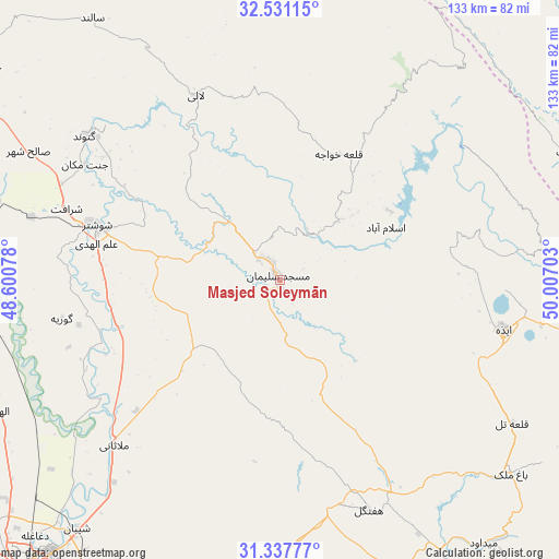
Masjed Soleymān GPS coordinates[2]
31° 56' 11.04" North, 49° 18' 14.04" East
| Map corner | latitude | longitude |
|---|---|---|
| Upper-left | 32.53115°, | 48.60078° |
| Center: | 31.9364°, | 49.3039° |
| Lower-right: | 31.33777°, | 50.00703° |
| Map W x H: | 132.7×132.7 km | = 82.5×82.5mi |
| max Lat: | 39.6482° ⇑70.3% North |
| Masjed Soleymān: | 31.9364° |
| min Lat: | ⇓29.7% South 25.2919° |
| min Long | Masjed Soleymā | max Long |
| 44.38416° | 49.3039° | 61.9965° |
| W 31.3%⇐ | ⇒68.7% E |
Elevation
Elevation of Masjed Soleymān is 240 m = 787 ft, and this is 809 m = 2654 ft below average elevation for this country.
| Max E: |
2564 m = 8412 ft | 78% |
| Avg. | 1049 m = 3442 ft | |
| Masjed Soleymān | 240 m = 787 ft | |
Min E: |
-24 m = -79 ft | 22% |
See also: Masjed Soleymān elevation on elevation.city.
Geographical zone
Masjed Soleymān is located in North temperate zone (between Tropic of Cancer and the Arctic Circle). Distance of this Northern Tropic circle is 945.1 km =587.3 mi to South.| Distance of | km | miles | from Masjed Soleymān |
|---|---|---|---|
| North Pole | 6456.1 | 4011.6 | to North |
| Arctic Circle | 3850.2 | 2392.4 | to North |
| Tropic Cancer | 945.1 | 587.3 | to South |
| Equator | 3551 | 2206.5 | to South |


Nearby cities:
15 places around Masjed Soleymān: (largest is in red/bold)
• Ahvaz
90.3 km =56.1 mi,  220°
220°
• Andīmeshk
106.8 km =66.4 mi,  303°
303°
• Bāgh-e Malek
71.6 km =44.5 mi,  129°
129°
• Chelgard
97 km =60.3 mi,  52°
52°
• Dasht-e Lati
48 km =29.8 mi,  335°
335°
• Dezful
97.9 km =60.8 mi, 300°
• Haftkel
58.5 km =36.4 mi,  158°
158°
• Jongīyeh
99.8 km =62 mi, 220°
• Mollās̄ānī
55.6 km =34.5 mi,  225°
225°
• Qal‘eh-ye Khvājeh
32.8 km =20.4 mi,  23°
23°
• Rāmhormoz
78.3 km =48.7 mi, 158°
• Shahrak-e Kūlūrī
91.1 km =56.6 mi, 300°
• Shūsh
103.9 km =64.6 mi,  286°
286°
• Shūshtar
44.8 km =27.8 mi, 286°
• sedeyen-e Yek
78.7 km =48.9 mi, 215°
Sources, notices
• [Note1] Compared only with cities in Iran existing in our database
• [Src1] Map data: © OpenStreetMap contributors (CC-BY-SA)
• [Src2] Other city data from geonames.org with taken over terms of usage.
• [Src3] Geographical zone / Annual Mean Temperature by Robert A. Rohde @ Wikipedia
