Aghajari geodata
Aghajari (Khuzestan) is a populated place; located in Iran in Asia/Tehran (GMT+3.5) time zone. With population of 21,785 people, there are 189 cities with bigger population in this country. Compared to other cities in Iran, 78.2% of cities are located further ↑North; 63.9% of cities are located further →East and 80.3% of cities have higher elevation than Aghajari. Note1


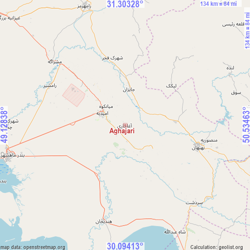
Aghajari GPS coordinates[2]
30° 42' 2.16" North, 49° 49' 53.4" East
| Map corner | latitude | longitude |
|---|---|---|
| Upper-left | 31.30328°, | 49.12838° |
| Center: | 30.7006°, | 49.8315° |
| Lower-right: | 30.09413°, | 50.53463° |
| Map W x H: | 134.4×134.4 km | = 83.5×83.5mi |
| max Lat: | 39.6482° ⇑78.2% North |
| Aghajari: | 30.7006° |
| min Lat: | ⇓21.8% South 25.2919° |
| min Long | Aghajari | max Long |
| 44.38416° | 49.8315° | 61.9965° |
| W 36.1%⇐ | ⇒63.9% E |
Elevation
Elevation of Aghajari is 151 m = 495 ft, and this is 898 m = 2946 ft below average elevation for this country.
| Max E: |
2564 m = 8412 ft | 80.3% |
| Avg. | 1049 m = 3442 ft | |
| Aghajari | 151 m = 495 ft | |
Min E: |
-24 m = -79 ft | 19.7% |
See also: Iran elevation on elevation.city.
Geographical zone
Aghajari is located in North temperate zone (between Tropic of Cancer and the Arctic Circle). Distance of this Northern Tropic circle is 807.7 km =501.9 mi to South.| Distance of | km | miles | from Aghajari |
|---|---|---|---|
| North Pole | 6593.5 | 4097 | to North |
| Arctic Circle | 3987.6 | 2477.8 | to North |
| Tropic Cancer | 807.7 | 501.9 | to South |
| Equator | 3413.6 | 2121.1 | to South |


Nearby cities:
15 places around Aghajari: (largest is in red/bold)
• Bandar-e Deylam
78.4 km =48.7 mi,  156°
156°
• Bandar-e Emam Khomeyni
75.7 km =47 mi,  247°
247°
• Bandar-e Māhshahr
63.6 km =39.5 mi,  255°
255°
• Behbahān
40.9 km =25.4 mi,  106°
106°
• Bāgh-e Malek
91.7 km =57 mi,  3°
3°
• Dehdasht
70.8 km =44 mi,  81°
81°
• Dogonbadan
100.1 km =62.2 mi, 112°
• Haftkel
87.8 km =54.6 mi,  340°
340°
• Hendījān
52.9 km =32.9 mi,  192°
192°
• Līkak
33 km =20.5 mi,  49°
49°
• Omīdīyeh
14.2 km =8.8 mi,  299°
299°
• Rāmhormoz
68 km =42.3 mi, 341°
• Rāmshīr
45.8 km =28.5 mi, 297°
• Shādegān
111.7 km =69.4 mi,  267°
267°
• sedeyen-e Yek
121.4 km =75.4 mi,  307°
307°
Sources, notices
• [Note1] Compared only with cities in Iran existing in our database
• [Src1] Map data: © OpenStreetMap contributors (CC-BY-SA)
• [Src2] Other city data from geonames.org with taken over terms of usage.
• [Src3] Geographical zone / Annual Mean Temperature by Robert A. Rohde @ Wikipedia
