Līkak geodata
Līkak (Kohgiluyeh and Boyer-Ahmad) is a seat of a second-order administrative division; located in Iran in Asia/Tehran (GMT+3.5) time zone. In our database, there are 232 cities with bigger population. Compared to other cities in Iran, 76.4% of cities are located further ↑North; 61.5% of cities are located further →East and 71% of cities have higher elevation than Līkak. Note1


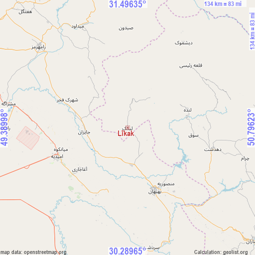
Līkak GPS coordinates[2]
30° 53' 41.64" North, 50° 5' 35.16" East
| Map corner | latitude | longitude |
|---|---|---|
| Upper-left | 31.49635°, | 49.38998° |
| Center: | 30.8949°, | 50.0931° |
| Lower-right: | 30.28965°, | 50.79623° |
| Map W x H: | 134.2×134.2 km | = 83.4×83.4mi |
| max Lat: | 39.6482° ⇑76.4% North |
| Līkak: | 30.8949° |
| min Lat: | ⇓23.6% South 25.2919° |
| min Long | Līkak | max Long |
| 44.38416° | 50.0931° | 61.9965° |
| W 38.5%⇐ | ⇒61.5% E |
Elevation
Elevation of Līkak is 652 m = 2139 ft, and this is 397 m = 1302 ft below average elevation for this country.
| Max E: |
2564 m = 8412 ft | 71% |
| Avg. | 1049 m = 3442 ft | |
| Līkak | 652 m = 2139 ft | |
Min E: |
-24 m = -79 ft | 29% |
See also: Iran elevation on elevation.city.
Geographical zone
Līkak is located in North temperate zone (between Tropic of Cancer and the Arctic Circle). Distance of this Northern Tropic circle is 829.3 km =515.3 mi to South.| Distance of | km | miles | from Līkak |
|---|---|---|---|
| North Pole | 6571.9 | 4083.6 | to North |
| Arctic Circle | 3966 | 2464.4 | to North |
| Tropic Cancer | 829.3 | 515.3 | to South |
| Equator | 3435.2 | 2134.5 | to South |


Nearby cities:
15 places around Līkak: (largest is in red/bold)
• Aghajari
33 km =20.5 mi,  229°
229°
• Bandar-e Deylam
93.7 km =58.2 mi,  176°
176°
• Bandar-e Emam Khomeyni
107.5 km =66.8 mi,  241°
241°
• Bandar-e Māhshahr
94.3 km =58.6 mi,  246°
246°
• Behbahān
36.2 km =22.5 mi,  156°
156°
• Bāgh-e Malek
72.7 km =45.2 mi,  344°
344°
• Bāsht
117.9 km =73.3 mi,  120°
120°
• Dehdasht
46.4 km =28.8 mi,  103°
103°
• Dogonbadan
90 km =55.9 mi,  131°
131°
• Haftkel
81.5 km =50.6 mi,  318°
318°
• Hendījān
81.8 km =50.8 mi,  206°
206°
• Lordegān
98 km =60.9 mi,  45°
45°
• Omīdīyeh
40.1 km =24.9 mi, 248°
• Rāmhormoz
63.3 km =39.3 mi,  312°
312°
• Rāmshīr
65.4 km =40.6 mi,  269°
269°
Sources, notices
• [Note1] Compared only with cities in Iran existing in our database
• [Src1] Map data: © OpenStreetMap contributors (CC-BY-SA)
• [Src2] Other city data from geonames.org with taken over terms of usage.
• [Src3] Geographical zone / Annual Mean Temperature by Robert A. Rohde @ Wikipedia
