Mollās̄ānī geodata
Mollās̄ānī (Khuzestan) is a seat of a second-order administrative division; located in Iran in Asia/Tehran (GMT+3.5) time zone. In our database, there are 232 cities with bigger population. Compared to other cities in Iran, 71.7% of cities are located further ↑North; 72.8% of cities are located further →East and 87.3% of cities have higher elevation than Mollās̄ānī. Note1


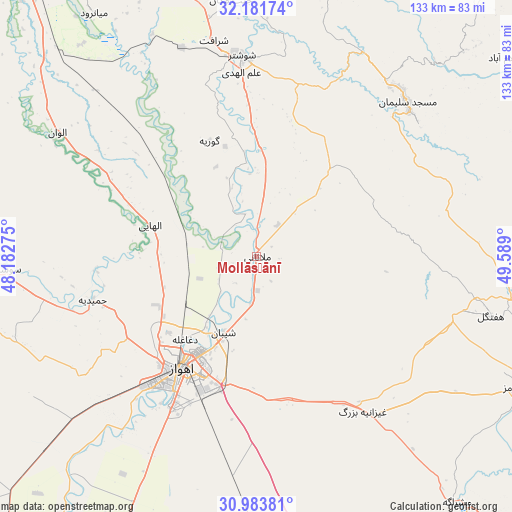
Mollās̄ānī GPS coordinates[2]
31° 35' 4.92" North, 48° 53' 9.132" East
| Map corner | latitude | longitude |
|---|---|---|
| Upper-left | 32.18174°, | 48.18275° |
| Center: | 31.5847°, | 48.88587° |
| Lower-right: | 30.98381°, | 49.589° |
| Map W x H: | 133.2×133.2 km | = 82.8×82.8mi |
| max Lat: | 39.6482° ⇑71.7% North |
| Mollās̄ānī: | 31.5847° |
| min Lat: | ⇓28.3% South 25.2919° |
| min Long | Mollās̄ānī | max Long |
| 44.38416° | 48.88587° | 61.9965° |
| W 27.2%⇐ | ⇒72.8% E |
Elevation
Elevation of Mollās̄ānī is 28 m = 92 ft, and this is 1021 m = 3350 ft below average elevation for this country.
| Max E: |
2564 m = 8412 ft | 87.3% |
| Avg. | 1049 m = 3442 ft | |
| Mollās̄ānī | 28 m = 92 ft | |
Min E: |
-24 m = -79 ft | 12.7% |
See also: Iran elevation on elevation.city.
Geographical zone
Mollās̄ānī is located in North temperate zone (between Tropic of Cancer and the Arctic Circle). Distance of this Northern Tropic circle is 906 km =563 mi to South.| Distance of | km | miles | from Mollās̄ānī |
|---|---|---|---|
| North Pole | 6495.2 | 4035.9 | to North |
| Arctic Circle | 3889.3 | 2416.7 | to North |
| Tropic Cancer | 906 | 563 | to South |
| Equator | 3511.9 | 2182.2 | to South |


Nearby cities:
15 places around Mollās̄ānī: (largest is in red/bold)
• Ahvaz
35.2 km =21.9 mi,  212°
212°
• Bāgh-e Malek
95 km =59 mi,  94°
94°
• Dasht-e Lati
85.1 km =52.9 mi,  13°
13°
• Haftkel
62.9 km =39.1 mi,  104°
104°
• Hoveyzeh
78.2 km =48.6 mi,  259°
259°
• Jongīyeh
44.6 km =27.7 mi, 214°
• Masjed Soleymān
55.6 km =34.5 mi,  45°
45°
• Qal‘eh-ye Khvājeh
87 km =54.1 mi,  37°
37°
• Rāmhormoz
76 km =47.2 mi,  116°
116°
• Rāmshīr
91.5 km =56.9 mi,  147°
147°
• Shahrak-e Kūlūrī
94 km =58.4 mi,  335°
335°
• Shūsh
90.9 km =56.5 mi,  318°
318°
• Shūshtar
51.8 km =32.2 mi,  356°
356°
• Sūsangerd
66 km =41 mi,  267°
267°
• sedeyen-e Yek
25.6 km =15.9 mi,  194°
194°
Sources, notices
• [Note1] Compared only with cities in Iran existing in our database
• [Src1] Map data: © OpenStreetMap contributors (CC-BY-SA)
• [Src2] Other city data from geonames.org with taken over terms of usage.
• [Src3] Geographical zone / Annual Mean Temperature by Robert A. Rohde @ Wikipedia
