Īstgāh-e Rāh Āhan-e Garmsār geodata
Īstgāh-e Rāh Āhan-e Garmsār (Semnan) is a populated place; located in Iran in Asia/Tehran (GMT+3.5) time zone. With population of 49,491 people, there are 131 cities with bigger population in this country. Compared to other cities in Iran, 58% of cities are located further ↓South; 60.1% of cities are located further ←West and 65.3% of cities have higher elevation than Īstgāh-e Rāh Āhan-e Garmsār. Note1
Current local time in Īstgāh-e Rāh Āhan-e Garmsār:
02:15 PM, TuesdayDifference from your time zone: hours


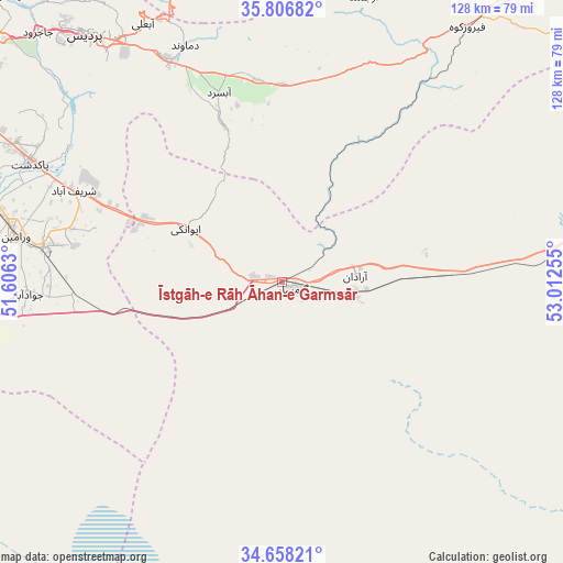
Īstgāh-e Rāh Āhan-e Garmsār GPS coordinates[2]
35° 14' 4.38" North, 52° 18' 33.912" East
| Map corner | latitude | longitude |
|---|---|---|
| Upper-left | 35.80682°, | 51.6063° |
| Center: | 35.23455°, | 52.30942° |
| Lower-right: | 34.65821°, | 53.01255° |
| Map W x H: | 127.7×127.7 km | = 79.3×79.3mi |
| max Lat: | 39.6482° ⇑42% North |
| Īstgāh-e Rāh Āhan-e Garmsār: | 35.23455° |
| min Lat: | ⇓58% South 25.2919° |
| min Long | Īstgāh-e Rāh | max Long |
| 44.38416° | 52.30942° | 61.9965° |
| W 60.1%⇐ | ⇒39.9% E |
Elevation
Elevation of Īstgāh-e Rāh Āhan-e Garmsār is 848 m = 2782 ft, and this is 201 m = 659 ft below average elevation for this country.
| Max E: |
2564 m = 8412 ft | 65.3% |
| Avg. | 1049 m = 3442 ft | |
| Īstgāh-e Rāh Āhan-e Garmsār | 848 m = 2782 ft | |
Min E: |
-24 m = -79 ft | 34.7% |
See also: Īstgāh-e Rāh Āhan-e Garmsār elevation on elevation.city.
Geographical zone
Īstgāh-e Rāh Āhan-e Garmsār is located in North temperate zone (between Tropic of Cancer and the Arctic Circle). Distance of this Northern Tropic circle is 1311.8 km =815.1 mi to South.| Distance of | km | miles | from Īstgāh-e Rāh Āhan-e Garmsār |
|---|---|---|---|
| North Pole | 6089.3 | 3783.7 | to North |
| Arctic Circle | 3483.5 | 2164.5 | to North |
| Tropic Cancer | 1311.8 | 815.1 | to South |
| Equator | 3917.7 | 2434.3 | to South |


Nearby cities:
15 places around Īstgāh-e Rāh Āhan-e Garmsār: (largest is in red/bold)
• Damāvand
58 km =36 mi,  338°
338°
• Eqbālīyeh
70.6 km =43.9 mi,  276°
276°
• Fīrūzkūh
71.5 km =44.4 mi,  35°
35°
• Garmsār
3.4 km =2.1 mi,  122°
122°
• Pākdasht
62.9 km =39.1 mi,  295°
295°
• Pīshvā
53.5 km =33.2 mi, 278°
• Qarchak
70 km =43.5 mi,  287°
287°
• Rey
88.3 km =54.9 mi, 296°
• Shahrak-e Emām Ḩasan
91.8 km =57 mi, 287°
• Sharīfābād
52.2 km =32.4 mi, 294°
• Soleh Bon
63.6 km =39.5 mi,  20°
20°
• Sorkheh
85.9 km =53.4 mi,  72°
72°
• Varāmīn
61.1 km =38 mi, 279°
• Ārādān
16.9 km =10.5 mi,  84°
84°
• Ţāleb ābād
76.5 km =47.5 mi, 292°
Sources, notices
• [Note1] Compared only with cities in Iran existing in our database
• [Src1] Map data: © OpenStreetMap contributors (CC-BY-SA)
• [Src2] Other city data from geonames.org with taken over terms of usage.
• [Src3] Geographical zone / Annual Mean Temperature by Robert A. Rohde @ Wikipedia
