Qarah Āghāj geodata
Qarah Āghāj (East Azerbaijan) is a seat of a second-order administrative division; located in Iran in Asia/Tehran (GMT+3.5) time zone. In our database, there are 232 cities with bigger population. Compared to other cities in Iran, 86.8% of cities are located further ↓South; 86.6% of cities are located further →East and 90.7% of cities have lower elevation than Qarah Āghāj. Note1


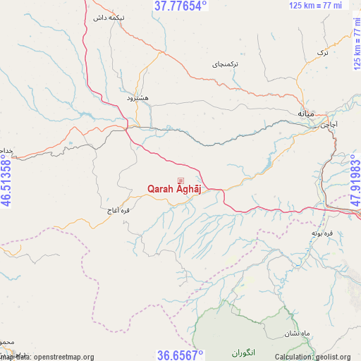
Qarah Āghāj GPS coordinates[2]
37° 13' 7.32" North, 47° 13' 0.12" East
| Map corner | latitude | longitude |
|---|---|---|
| Upper-left | 37.77654°, | 46.51358° |
| Center: | 37.2187°, | 47.2167° |
| Lower-right: | 36.6567°, | 47.91983° |
| Map W x H: | 124.5×124.5 km | = 77.4×77.4mi |
| max Lat: | 39.6482° ⇑13.2% North |
| Qarah Āghāj: | 37.2187° |
| min Lat: | ⇓86.8% South 25.2919° |
| min Long | Qarah Āghāj | max Long |
| 44.38416° | 47.2167° | 61.9965° |
| W 13.4%⇐ | ⇒86.6% E |
Elevation
Elevation of Qarah Āghāj is 1867 m = 6125 ft, and this is 818 m = 2684 ft above average elevation for this country.
| Max E: |
2564 m = 8412 ft | 9.3% |
| Qarah Āghāj | 1867 m 6125 ft | |
| Avg. | 1049 m = 3442 ft | |
Min E: |
-24 m = -79 ft | 90.7% |
See also: Iran elevation on elevation.city.
Geographical zone
Qarah Āghāj is located in North temperate zone (between Tropic of Cancer and the Arctic Circle). Distance of this Northern Tropic circle is 1532.4 km =952.2 mi to South.| Distance of | km | miles | from Qarah Āghāj |
|---|---|---|---|
| North Pole | 5868.7 | 3646.6 | to North |
| Arctic Circle | 3262.8 | 2027.4 | to North |
| Tropic Cancer | 1532.4 | 952.2 | to South |
| Equator | 4138.3 | 2571.4 | to South |


Nearby cities:
15 places around Qarah Āghāj: (largest is in red/bold)
• Bonāb
103.6 km =64.4 mi,  277°
277°
• Bostānābād
77.5 km =48.2 mi,  334°
334°
• Gīvī
112.1 km =69.7 mi,  62°
62°
• Hashtrūd
32.3 km =20.1 mi, 333°
• Herīs
114.8 km =71.3 mi,  355°
355°
• Kandovān
106.7 km =66.3 mi,  306°
306°
• Malekān
99 km =61.5 mi,  265°
265°
• Marāgheh
88.6 km =55.1 mi, 282°
• Māhneshān
66.5 km =41.3 mi,  142°
142°
• Mīāndoāb
102.1 km =63.4 mi,  254°
254°
• Mīāneh
49.5 km =30.8 mi, 62°
• Nīr
113.9 km =70.8 mi,  37°
37°
• Sarāb
85.1 km =52.9 mi,  19°
19°
• Shāhīn Dezh
83.3 km =51.8 mi,  223°
223°
• Takāb
91.4 km =56.8 mi,  185°
185°
Sources, notices
• [Note1] Compared only with cities in Iran existing in our database
• [Src1] Map data: © OpenStreetMap contributors (CC-BY-SA)
• [Src2] Other city data from geonames.org with taken over terms of usage.
• [Src3] Geographical zone / Annual Mean Temperature by Robert A. Rohde @ Wikipedia
