Herīs geodata
Herīs (East Azerbaijan) is a seat of a second-order administrative division; located in Iran in Asia/Tehran (GMT+3.5) time zone. In our database, there are 232 cities with bigger population. Compared to other cities in Iran, 95.5% of cities are located further ↓South; 86.8% of cities are located further →East and 90.9% of cities have lower elevation than Herīs. Note1


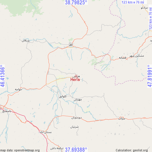
Herīs GPS coordinates[2]
38° 14' 53.376" North, 47° 7' 0.408" East
| Map corner | latitude | longitude |
|---|---|---|
| Upper-left | 38.79825°, | 46.41366° |
| Center: | 38.24816°, | 47.11678° |
| Lower-right: | 37.69388°, | 47.81991° |
| Map W x H: | 122.8×122.8 km | = 76.3×76.3mi |
| max Lat: | 39.6482° ⇑4.5% North |
| Herīs: | 38.24816° |
| min Lat: | ⇓95.5% South 25.2919° |
| min Long | Herīs | max Long |
| 44.38416° | 47.11678° | 61.9965° |
| W 13.2%⇐ | ⇒86.8% E |
Elevation
Elevation of Herīs is 1904 m = 6247 ft, and this is 855 m = 2805 ft above average elevation for this country.
| Max E: |
2564 m = 8412 ft | 9.1% |
| Herīs | 1904 m 6247 ft | |
| Avg. | 1049 m = 3442 ft | |
Min E: |
-24 m = -79 ft | 90.9% |
See also: Iran elevation on elevation.city.
Geographical zone
Herīs is located in North temperate zone (between Tropic of Cancer and the Arctic Circle). Distance of this Northern Tropic circle is 1646.9 km =1023.3 mi to South.| Distance of | km | miles | from Herīs |
|---|---|---|---|
| North Pole | 5754.3 | 3575.6 | to North |
| Arctic Circle | 3148.4 | 1956.3 | to North |
| Tropic Cancer | 1646.9 | 1023.3 | to South |
| Equator | 4252.8 | 2642.6 | to South |


Nearby cities:
15 places around Herīs: (largest is in red/bold)
• Ahar
25.8 km =16 mi,  350°
350°
• Ardabīl
102.7 km =63.8 mi,  89°
89°
• Bostānābād
51 km =31.7 mi,  208°
208°
• Hashtrūd
85.8 km =53.3 mi,  183°
183°
• Kaleybar
68.9 km =42.8 mi, 354°
• Kandovān
91.2 km =56.7 mi,  236°
236°
• Khomārlū
100.4 km =62.4 mi,  355°
355°
• Meshgīn Shahr
52.1 km =32.4 mi,  71°
71°
• Mīāneh
105.9 km =65.8 mi,  150°
150°
• Nīr
80.7 km =50.1 mi,  107°
107°
• Omīdcheh
89.5 km =55.6 mi, 87°
• Oskū
94.6 km =58.8 mi,  246°
246°
• Sarāb
50.2 km =31.2 mi,  132°
132°
• Tabriz
74.5 km =46.3 mi,  255°
255°
• Varazqān
99.5 km =61.8 mi,  298°
298°
Sources, notices
• [Note1] Compared only with cities in Iran existing in our database
• [Src1] Map data: © OpenStreetMap contributors (CC-BY-SA)
• [Src2] Other city data from geonames.org with taken over terms of usage.
• [Src3] Geographical zone / Annual Mean Temperature by Robert A. Rohde @ Wikipedia
