Malekān geodata
Malekān (East Azerbaijan) is a seat of a second-order administrative division; located in Iran in Asia/Tehran (GMT+3.5) time zone. In our database, there are 232 cities with bigger population. Compared to other cities in Iran, 85.5% of cities are located further ↓South; 94.8% of cities are located further →East and 57.4% of cities have lower elevation than Malekān. Note1


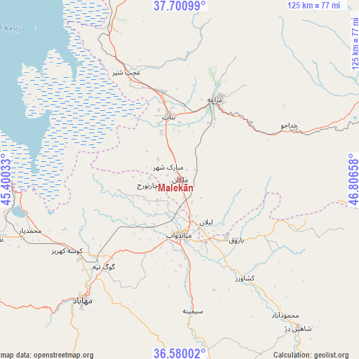
Malekān GPS coordinates[2]
37° 8' 33.288" North, 46° 6' 12.42" East
| Map corner | latitude | longitude |
|---|---|---|
| Upper-left | 37.70099°, | 45.40033° |
| Center: | 37.14258°, | 46.10345° |
| Lower-right: | 36.58002°, | 46.80658° |
| Map W x H: | 124.6×124.6 km | = 77.4×77.4mi |
| max Lat: | 39.6482° ⇑14.5% North |
| Malekān: | 37.14258° |
| min Lat: | ⇓85.5% South 25.2919° |
| min Long | Malekān | max Long |
| 44.38416° | 46.10345° | 61.9965° |
| W 5.2%⇐ | ⇒94.8% E |
Elevation
Elevation of Malekān is 1299 m = 4262 ft, and this is 250 m = 820 ft above average elevation for this country.
| Max E: |
2564 m = 8412 ft | 42.6% |
| Malekān | 1299 m 4262 ft | |
| Avg. | 1049 m = 3442 ft | |
Min E: |
-24 m = -79 ft | 57.4% |
See also: Iran elevation on elevation.city.
Geographical zone
Malekān is located in North temperate zone (between Tropic of Cancer and the Arctic Circle). Distance of this Northern Tropic circle is 1523.9 km =946.9 mi to South.| Distance of | km | miles | from Malekān |
|---|---|---|---|
| North Pole | 5877.2 | 3651.9 | to North |
| Arctic Circle | 3271.3 | 2032.7 | to North |
| Tropic Cancer | 1523.9 | 946.9 | to South |
| Equator | 4129.9 | 2566.2 | to South |


Nearby cities:
15 places around Malekān: (largest is in red/bold)
• Bonāb
22.4 km =13.9 mi,  349°
349°
• Būkān
69.7 km =43.3 mi,  172°
172°
• Hashtrūd
91.7 km =57 mi,  66°
66°
• Kandovān
73.7 km =45.8 mi,  10°
10°
• Mahābād
54.1 km =33.6 mi,  218°
218°
• Marāgheh
30.2 km =18.8 mi,  23°
23°
• Mīāndoāb
19.6 km =12.2 mi,  178°
178°
• Naqadeh
66.8 km =41.5 mi,  251°
251°
• Oshnavīyeh
89.9 km =55.9 mi,  262°
262°
• Oskū
85.9 km =53.4 mi,  1°
1°
• Piranshahr
98.6 km =61.3 mi,  240°
240°
• Qarah Āghāj
99 km =61.5 mi,  85°
85°
• Shāhīn Dezh
66 km =41 mi,  141°
141°
• Āz̄arshahr
69.4 km =43.1 mi, 350°
• ‘Ajab Shīr
41.6 km =25.8 mi,  333°
333°
Sources, notices
• [Note1] Compared only with cities in Iran existing in our database
• [Src1] Map data: © OpenStreetMap contributors (CC-BY-SA)
• [Src2] Other city data from geonames.org with taken over terms of usage.
• [Src3] Geographical zone / Annual Mean Temperature by Robert A. Rohde @ Wikipedia
