Mīāndoāb geodata
Mīāndoāb (West Azerbaijan) is a seat of a second-order administrative division; located in Iran in Asia/Tehran (GMT+3.5) time zone. With population of 132,819 people, there are 52 cities with bigger population in this country. Compared to other cities in Iran, 82.8% of cities are located further ↓South; 94.6% of cities are located further →East and 56.9% of cities have lower elevation than Mīāndoāb. Note1


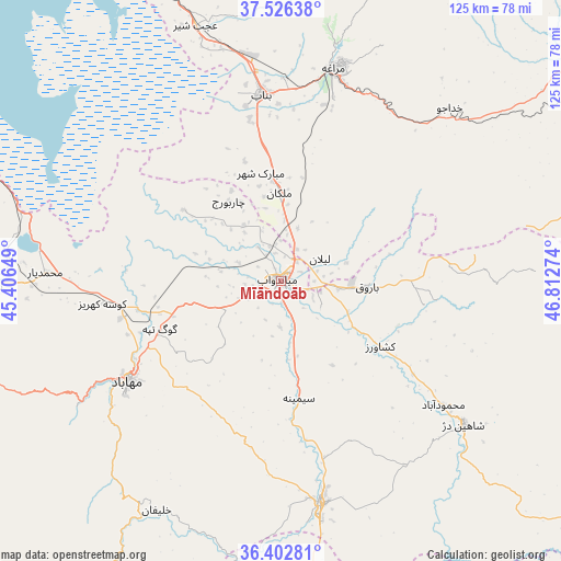
Mīāndoāb GPS coordinates[2]
36° 58' 0.012" North, 46° 6' 34.596" East
| Map corner | latitude | longitude |
|---|---|---|
| Upper-left | 37.52638°, | 45.40649° |
| Center: | 36.96667°, | 46.10961° |
| Lower-right: | 36.40281°, | 46.81274° |
| Map W x H: | 124.9×124.9 km | = 77.6×77.6mi |
| max Lat: | 39.6482° ⇑17.2% North |
| Mīāndoāb: | 36.96667° |
| min Lat: | ⇓82.8% South 25.2919° |
| min Long | Mīāndoāb | max Long |
| 44.38416° | 46.10961° | 61.9965° |
| W 5.4%⇐ | ⇒94.6% E |
Elevation
Elevation of Mīāndoāb is 1294 m = 4245 ft, and this is 245 m = 804 ft above average elevation for this country.
| Max E: |
2564 m = 8412 ft | 43.1% |
| Mīāndoāb | 1294 m 4245 ft | |
| Avg. | 1049 m = 3442 ft | |
Min E: |
-24 m = -79 ft | 56.9% |
See also: Mīāndoāb elevation on elevation.city.
Geographical zone
Mīāndoāb is located in North temperate zone (between Tropic of Cancer and the Arctic Circle). Distance of this Northern Tropic circle is 1504.4 km =934.8 mi to South.| Distance of | km | miles | from Mīāndoāb |
|---|---|---|---|
| North Pole | 5896.8 | 3664.1 | to North |
| Arctic Circle | 3290.9 | 2044.9 | to North |
| Tropic Cancer | 1504.4 | 934.8 | to South |
| Equator | 4110.3 | 2554 | to South |


Nearby cities:
15 places around Mīāndoāb: (largest is in red/bold)
• Bonāb
41.8 km =26 mi,  353°
353°
• Būkān
50.3 km =31.3 mi,  169°
169°
• Hashtrūd
100.9 km =62.7 mi,  55°
55°
• Kandovān
92.9 km =57.7 mi,  7°
7°
• Mahābād
41.2 km =25.6 mi,  236°
236°
• Malekān
19.6 km =12.2 mi,  358°
358°
• Marāgheh
48.7 km =30.3 mi, 13°
• Naqadeh
64.1 km =39.8 mi,  268°
268°
• Oshnavīyeh
90.2 km =56 mi,  275°
275°
• Piranshahr
91.1 km =56.6 mi,  251°
251°
• Qarah Āghāj
102.1 km =63.4 mi,  74°
74°
• Saqqez
81 km =50.3 mi, 169°
• Shāhīn Dezh
51.7 km =32.1 mi,  128°
128°
• Āz̄arshahr
88.9 km =55.2 mi, 352°
• ‘Ajab Shīr
59.9 km =37.2 mi,  341°
341°
Sources, notices
• [Note1] Compared only with cities in Iran existing in our database
• [Src1] Map data: © OpenStreetMap contributors (CC-BY-SA)
• [Src2] Other city data from geonames.org with taken over terms of usage.
• [Src3] Geographical zone / Annual Mean Temperature by Robert A. Rohde @ Wikipedia
