Shāhīn Dezh geodata
Shāhīn Dezh (West Azerbaijan) is a seat of a second-order administrative division; located in Iran in Asia/Tehran (GMT+3.5) time zone. With population of 41,442 people, there are 150 cities with bigger population in this country. Compared to other cities in Iran, 77.3% of cities are located further ↓South; 90% of cities are located further →East and 63.5% of cities have lower elevation than Shāhīn Dezh. Note1


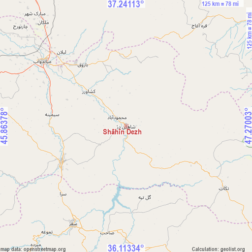
Shāhīn Dezh GPS coordinates[2]
36° 40' 45.48" North, 46° 34' 0.84" East
| Map corner | latitude | longitude |
|---|---|---|
| Upper-left | 37.24113°, | 45.86378° |
| Center: | 36.6793°, | 46.5669° |
| Lower-right: | 36.11334°, | 47.27003° |
| Map W x H: | 125.4×125.4 km | = 77.9×77.9mi |
| max Lat: | 39.6482° ⇑22.7% North |
| Shāhīn Dezh: | 36.6793° |
| min Lat: | ⇓77.3% South 25.2919° |
| min Long | Shāhīn Dezh | max Long |
| 44.38416° | 46.5669° | 61.9965° |
| W 10%⇐ | ⇒90% E |
Elevation
Elevation of Shāhīn Dezh is 1370 m = 4495 ft, and this is 321 m = 1053 ft above average elevation for this country.
| Max E: |
2564 m = 8412 ft | 36.5% |
| Shāhīn Dezh | 1370 m 4495 ft | |
| Avg. | 1049 m = 3442 ft | |
Min E: |
-24 m = -79 ft | 63.5% |
See also: Shāhīn Dezh elevation on elevation.city.
Geographical zone
Shāhīn Dezh is located in North temperate zone (between Tropic of Cancer and the Arctic Circle). Distance of this Northern Tropic circle is 1472.4 km =914.9 mi to South.| Distance of | km | miles | from Shāhīn Dezh |
|---|---|---|---|
| North Pole | 5928.7 | 3683.9 | to North |
| Arctic Circle | 3322.8 | 2064.7 | to North |
| Tropic Cancer | 1472.4 | 914.9 | to South |
| Equator | 4078.4 | 2534.2 | to South |


Nearby cities:
15 places around Shāhīn Dezh: (largest is in red/bold)
• Bonāb
86.4 km =53.7 mi,  328°
328°
• Bāneh
97.3 km =60.5 mi,  218°
218°
• Būkān
36.5 km =22.7 mi,  241°
241°
• Dīvāndarreh
94.4 km =58.7 mi,  154°
154°
• Hashtrūd
98.6 km =61.3 mi,  25°
25°
• Mahābād
75.9 km =47.2 mi,  277°
277°
• Malekān
66 km =41 mi,  321°
321°
• Marāgheh
84.4 km =52.4 mi,  339°
339°
• Māhneshān
98.8 km =61.4 mi,  85°
85°
• Mīāndoāb
51.7 km =32.1 mi,  308°
308°
• Naqadeh
109.3 km =67.9 mi,  286°
286°
• Qarah Āghāj
83.3 km =51.8 mi,  43°
43°
• Saqqez
54.5 km =33.9 mi,  208°
208°
• Takāb
57.8 km =35.9 mi,  122°
122°
• ‘Ajab Shīr
107 km =66.5 mi, 326°
Sources, notices
• [Note1] Compared only with cities in Iran existing in our database
• [Src1] Map data: © OpenStreetMap contributors (CC-BY-SA)
• [Src2] Other city data from geonames.org with taken over terms of usage.
• [Src3] Geographical zone / Annual Mean Temperature by Robert A. Rohde @ Wikipedia
