Marāgheh geodata
Marāgheh (East Azerbaijan) is a seat of a second-order administrative division; located in Iran in Asia/Tehran (GMT+3.5) time zone. In our database, there are 232 cities with bigger population. Compared to other cities in Iran, 89.8% of cities are located further ↓South; 93% of cities are located further →East and 68.3% of cities have lower elevation than Marāgheh. Note1


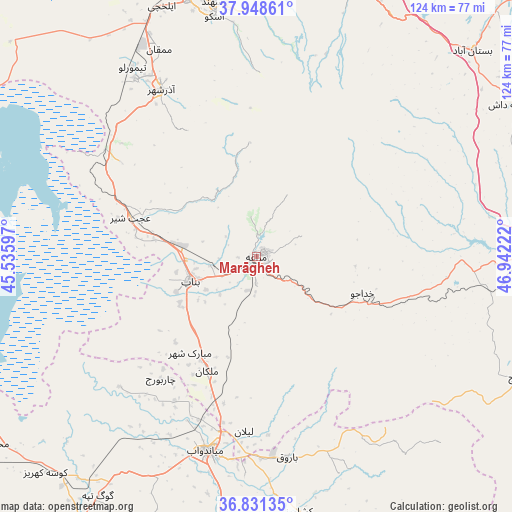
Marāgheh GPS coordinates[2]
37° 23' 31.416" North, 46° 14' 20.724" East
| Map corner | latitude | longitude |
|---|---|---|
| Upper-left | 37.94861°, | 45.53597° |
| Center: | 37.39206°, | 46.23909° |
| Lower-right: | 36.83135°, | 46.94222° |
| Map W x H: | 124.2×124.2 km | = 77.2×77.2mi |
| max Lat: | 39.6482° ⇑10.2% North |
| Marāgheh: | 37.39206° |
| min Lat: | ⇓89.8% South 25.2919° |
| min Long | Marāgheh | max Long |
| 44.38416° | 46.23909° | 61.9965° |
| W 7%⇐ | ⇒93% E |
Elevation
Elevation of Marāgheh is 1455 m = 4774 ft, and this is 406 m = 1332 ft above average elevation for this country.
| Max E: |
2564 m = 8412 ft | 31.7% |
| Marāgheh | 1455 m 4774 ft | |
| Avg. | 1049 m = 3442 ft | |
Min E: |
-24 m = -79 ft | 68.3% |
See also: Iran elevation on elevation.city.
Geographical zone
Marāgheh is located in North temperate zone (between Tropic of Cancer and the Arctic Circle). Distance of this Northern Tropic circle is 1551.7 km =964.2 mi to South.| Distance of | km | miles | from Marāgheh |
|---|---|---|---|
| North Pole | 5849.5 | 3634.7 | to North |
| Arctic Circle | 3243.6 | 2015.5 | to North |
| Tropic Cancer | 1551.7 | 964.2 | to South |
| Equator | 4157.6 | 2583.4 | to South |


Nearby cities:
15 places around Marāgheh: (largest is in red/bold)
• Bonāb
17.2 km =10.7 mi,  250°
250°
• Bostānābād
72.9 km =45.3 mi,  46°
46°
• Būkān
96.9 km =60.2 mi,  181°
181°
• Hashtrūd
72.3 km =44.9 mi,  82°
82°
• Kandovān
44.8 km =27.8 mi,  1°
1°
• Mahābād
83.6 km =51.9 mi,  213°
213°
• Malekān
30.2 km =18.8 mi,  203°
203°
• Mīāndoāb
48.7 km =30.3 mi,  193°
193°
• Naqadeh
89.7 km =55.7 mi,  237°
237°
• Oskū
59 km =36.7 mi,  349°
349°
• Qarah Āghāj
88.6 km =55.1 mi,  102°
102°
• Shāhīn Dezh
84.4 km =52.4 mi,  159°
159°
• Tabriz
76.6 km =47.6 mi, 3°
• Āz̄arshahr
46.8 km =29.1 mi,  330°
330°
• ‘Ajab Shīr
31.9 km =19.8 mi,  287°
287°
Sources, notices
• [Note1] Compared only with cities in Iran existing in our database
• [Src1] Map data: © OpenStreetMap contributors (CC-BY-SA)
• [Src2] Other city data from geonames.org with taken over terms of usage.
• [Src3] Geographical zone / Annual Mean Temperature by Robert A. Rohde @ Wikipedia
