Villaputzu geodata
Villaputzu (Sardinia) is a seat of a third-order administrative division; located in Italy in Europe/Rome (GMT+2) time zone. With population of 3,737 people, there are 2538 cities with bigger population in this country. Compared to other cities in Italy, 90.6% of cities are located further ↑North; 72.3% of cities are located further →East and 91.1% of cities have higher elevation than Villaputzu. Note1
Administrative division(s):
- Level 1: Sardinia
- Level 2: Provincia del Sud Sardegna
- Level 3: Villaputzu


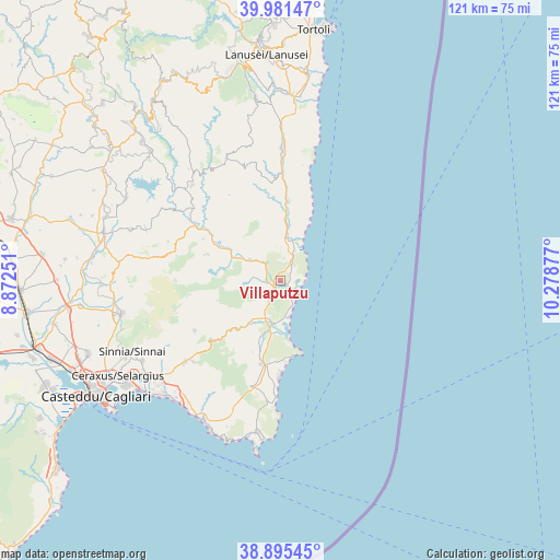
Villaputzu GPS coordinates[2]
39° 26' 26.088" North, 9° 34' 32.304" East
| Map corner | latitude | longitude |
|---|---|---|
| Upper-left | 39.98147°, | 8.87251° |
| Center: | 39.44058°, | 9.57564° |
| Lower-right: | 38.89545°, | 10.27877° |
| Map W x H: | 120.8×120.8 km | = 75.1×75.1mi |
| max Lat: | 47.04031° ⇑90.6% North |
| Villaputzu: | 39.44058° |
| min Lat: | ⇓9.4% South 35.50142° |
| min Long | Villaputzu | max Long |
| 6.69888° | 9.57564° | 18.48682° |
| W 27.7%⇐ | ⇒72.3% E |
Elevation
Elevation of Villaputzu is 16 m = 52 ft, and this is 290.7 m = 954 ft below average elevation for this country.
| Max E: |
2085 m = 6841 ft | 91.1% |
| Avg. | 306.7 m = 1006 ft | |
| Villaputzu | 16 m = 52 ft | |
Min E: |
-4 m = -13 ft | 8.9% |
See also: Italy elevation on elevation.city.
Geographical zone
Villaputzu is located in North temperate zone (between Tropic of Cancer and the Arctic Circle). Distance of this Northern Tropic circle is 1779.5 km =1105.7 mi to South.| Distance of | km | miles | from Villaputzu |
|---|---|---|---|
| North Pole | 5621.7 | 3493.2 | to North |
| Arctic Circle | 3015.8 | 1873.9 | to North |
| Tropic Cancer | 1779.5 | 1105.7 | to South |
| Equator | 4385.4 | 2725 | to South |


Nearby cities:
15 places around Villaputzu: (largest is in red/bold)
• Armungia
19 km =11.8 mi,  298°
298°
• Ballao
22 km =13.7 mi, 303°
• Burcei
21.4 km =13.3 mi,  239°
239°
• Castiadas
23.6 km =14.7 mi,  196°
196°
• Escalaplano
28 km =17.4 mi,  317°
317°
• Goni
29.3 km =18.2 mi, 301°
• Muravera
2.3 km =1.4 mi,  181°
181°
• Olia Speciosa
18.6 km =11.6 mi,  193°
193°
• Perdasdefogu
29 km =18 mi,  336°
336°
• San Nicolo'Gerrei
24 km =14.9 mi,  285°
285°
• San Vito
3 km =1.9 mi,  271°
271°
• Santa Maria
1.7 km =1.1 mi,  99°
99°
• Silius
25.7 km =16 mi, 289°
• Tertenia
28.3 km =17.6 mi,  0°
0°
• Villasalto
16.9 km =10.5 mi, 289°
Sources, notices
• [Note1] Compared only with cities in Italy existing in our database
• [Src1] Map data: © OpenStreetMap contributors (CC-BY-SA)
• [Src2] Other city data from geonames.org with taken over terms of usage.
• [Src3] Geographical zone / Annual Mean Temperature by Robert A. Rohde @ Wikipedia
