Caldarola geodata
Caldarola (The Marches) is a seat of a third-order administrative division; located in Italy in Europe/Rome (GMT+2) time zone. With population of 1,330 people, there are 5545 cities with bigger population in this country. Compared to other cities in Italy, 62.2% of cities are located further ↑North; 70.6% of cities are located further ←West and 60.3% of cities have lower elevation than Caldarola. Note1


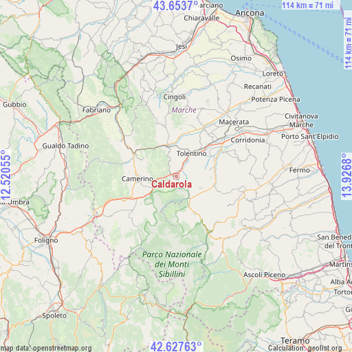
Caldarola GPS coordinates[2]
43° 8' 34.152" North, 13° 13' 25.212" East
| Map corner | latitude | longitude |
|---|---|---|
| Upper-left | 43.6537°, | 12.52055° |
| Center: | 43.14282°, | 13.22367° |
| Lower-right: | 42.62763°, | 13.9268° |
| Map W x H: | 114.1×114.1 km | = 70.9×70.9mi |
| max Lat: | 47.04031° ⇑62.2% North |
| Caldarola: | 43.14282° |
| min Lat: | ⇓37.8% South 35.50142° |
| min Long | Caldarola | max Long |
| 6.69888° | 13.22367° | 18.48682° |
| W 70.6%⇐ | ⇒29.4% E |
Elevation
Elevation of Caldarola is 301 m = 988 ft, and this is 5.7 m = 19 ft below average elevation for this country.
| Max E: |
2085 m = 6841 ft | 39.7% |
| Avg. | 306.7 m = 1006 ft | |
| Caldarola | 301 m = 988 ft | |
Min E: |
-4 m = -13 ft | 60.3% |
See also: Italy elevation on elevation.city.
Geographical zone
Caldarola is located in North temperate zone (between Tropic of Cancer and the Arctic Circle). Distance of this Northern Tropic circle is 2191.1 km =1361.5 mi to South.| Distance of | km | miles | from Caldarola |
|---|---|---|---|
| North Pole | 5210 | 3237.3 | to North |
| Arctic Circle | 2604.1 | 1618.1 | to North |
| Tropic Cancer | 2191.1 | 1361.5 | to South |
| Equator | 4797 | 2980.7 | to South |


Nearby cities:
15 places around Caldarola: (largest is in red/bold)
• Belforte del Chienti
2.9 km =1.8 mi,  33°
33°
• Camerino
12.7 km =7.9 mi,  267°
267°
• Camporotondo di Fiastrone
3.7 km =2.3 mi,  109°
109°
• Cesolo
13.4 km =8.3 mi,  349°
349°
• Cessapalombo
4.7 km =2.9 mi,  144°
144°
• Colmurano
11.3 km =7 mi,  77°
77°
• Gualdo
12.9 km =8 mi,  131°
131°
• Pie' del Colle
13.2 km =8.2 mi,  197°
197°
• Ripe San Ginesio
11.6 km =7.2 mi,  90°
90°
• San Ginesio
8.8 km =5.5 mi,  116°
116°
• San Severino Marche
10.4 km =6.5 mi,  339°
339°
• Serrapetrona
4.7 km =2.9 mi,  323°
323°
• Tolentino
8.9 km =5.5 mi, 34°
• Trebbio
13.1 km =8.1 mi,  205°
205°
• Urbisaglia
13.5 km =8.4 mi,  65°
65°
Sources, notices
• [Note1] Compared only with cities in Italy existing in our database
• [Src1] Map data: © OpenStreetMap contributors (CC-BY-SA)
• [Src2] Other city data from geonames.org with taken over terms of usage.
• [Src3] Geographical zone / Annual Mean Temperature by Robert A. Rohde @ Wikipedia
