Burmā geodata
Burmā (Jerash) is a seat of a third-order administrative division; located in Jordan in Asia/Amman (GMT+3) time zone. With population of 4,735 people, there are 68 cities with bigger population in this country. Compared to other cities in Jordan, 55.1% of cities are located further ↓South; 53.6% of cities are located further →East and 72.5% of cities have higher elevation than Burmā. Note1


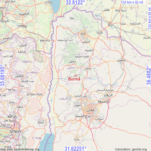
Burmā GPS coordinates[2]
32° 13' 9.48" North, 35° 47' 6.252" East
| Map corner | latitude | longitude |
|---|---|---|
| Upper-left | 32.8122°, | 35.08195° |
| Center: | 32.2193°, | 35.78507° |
| Lower-right: | 31.62251°, | 36.4882° |
| Map W x H: | 132.3×132.3 km | = 82.2×82.2mi |
| max Lat: | 33.31405° ⇑44.9% North |
| Burmā: | 32.2193° |
| min Lat: | ⇓55.1% South 29.40842° |
| min Long | Burmā | max Long |
| 34.97918° | 35.78507° | 38.70342° |
| W 46.4%⇐ | ⇒53.6% E |
Elevation
Elevation of Burmā is 571 m = 1873 ft, and this is 114.7 m = 376 ft below average elevation for this country.
| Max E: |
1440 m = 4724 ft | 72.5% |
| Avg. | 685.7 m = 2250 ft | |
| Burmā | 571 m = 1873 ft | |
Min E: |
-366 m = -1201 ft | 27.5% |
See also: Jordan elevation on elevation.city.
Geographical zone
Burmā is located in North temperate zone (between Tropic of Cancer and the Arctic Circle). Distance of this Northern Tropic circle is 976.5 km =606.8 mi to South.| Distance of | km | miles | from Burmā |
|---|---|---|---|
| North Pole | 6424.6 | 3992.1 | to North |
| Arctic Circle | 3818.7 | 2372.8 | to North |
| Tropic Cancer | 976.5 | 606.8 | to South |
| Equator | 3582.5 | 2226.1 | to South |


Nearby cities:
15 places around Burmā: (largest is in red/bold)
• Al Kittah
8.3 km =5.2 mi,  39°
39°
• Al Maşţabah
7.7 km =4.8 mi,  120°
120°
• Aş Şubayḩī
10.9 km =6.8 mi,  223°
223°
• Dayr ‘Allā
15.6 km =9.7 mi,  260°
260°
• Jarash
12.7 km =7.9 mi,  57°
57°
• Kufrinjah
11.7 km =7.3 mi,  318°
318°
• Raymūn
8 km =5 mi,  29°
29°
• Sakib
7.6 km =4.7 mi,  17°
17°
• Sūf
11.6 km =7.2 mi, 24°
• Şakhrah
17.7 km =11 mi, 17°
• ‘Ajlūn
13 km =8.1 mi,  346°
346°
• ‘Allān
11.9 km =7.4 mi,  199°
199°
• ‘Anjarah
10 km =6.2 mi,  344°
344°
• ‘Ayn Jannah
13 km =8.1 mi, 351°
• ‘Ayn al Bāshā
18.5 km =11.5 mi,  166°
166°
Sources, notices
• [Note1] Compared only with cities in Jordan existing in our database
• [Src1] Map data: © OpenStreetMap contributors (CC-BY-SA)
• [Src2] Other city data from geonames.org with taken over terms of usage.
• [Src3] Geographical zone / Annual Mean Temperature by Robert A. Rohde @ Wikipedia
