Tomioka geodata
Tomioka (Gunma) is a seat of a second-order administrative division; located in Japan in Asia/Tokyo (GMT+9) time zone. With population of 49,281 people, there are 379 cities with bigger population in this country. Compared to other cities in Japan, 72.8% of cities are located further ↓South; 59.2% of cities are located further ←West and 83.8% of cities have lower elevation than Tomioka. Note1


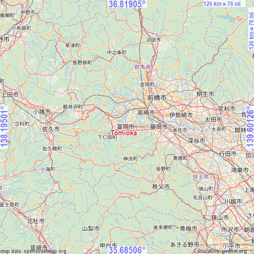
Tomioka GPS coordinates[2]
36° 15' 14.796" North, 138° 53' 53.268" East
| Map corner | latitude | longitude |
|---|---|---|
| Upper-left | 36.81905°, | 138.19501° |
| Center: | 36.25411°, | 138.89813° |
| Lower-right: | 35.68506°, | 139.60126° |
| Map W x H: | 126.1×126.1 km | = 78.4×78.4mi |
| max Lat: | 45.40944° ⇑27.2% North |
| Tomioka: | 36.25411° |
| min Lat: | ⇓72.8% South 24.34478° |
| min Long | Tomioka | max Long |
| 123° | 138.89813° | 145.575° |
| W 59.2%⇐ | ⇒40.8% E |
Elevation
Elevation of Tomioka is 158 m = 518 ft, and this is 73.4 m = 241 ft above average elevation for this country.
| Max E: |
1086 m = 3563 ft | 16.2% |
| Tomioka | 158 m 518 ft | |
| Avg. | 84.6 m = 278 ft | |
Min E: |
-2 m = -7 ft | 83.8% |
See also: Tomioka elevation on elevation.city.
Geographical zone
Tomioka is located in North temperate zone (between Tropic of Cancer and the Arctic Circle). Distance of this Northern Tropic circle is 1425.2 km =885.6 mi to South.| Distance of | km | miles | from Tomioka |
|---|---|---|---|
| North Pole | 5976 | 3713.3 | to North |
| Arctic Circle | 3370.1 | 2094.1 | to North |
| Tropic Cancer | 1425.2 | 885.6 | to South |
| Equator | 4031.1 | 2504.8 | to South |


Nearby cities:
15 places around Tomioka: (largest is in red/bold)
• Annaka
8.5 km =5.3 mi,  358°
358°
• Chichibu
33.4 km =20.8 mi,  151°
151°
• Fujioka
15.6 km =9.7 mi,  93°
93°
• Fukaya
33.6 km =20.9 mi,  104°
104°
• Honjō
26.3 km =16.3 mi, 93°
• Isesaki
27.9 km =17.3 mi,  75°
75°
• Kanekomachi
19.5 km =12.1 mi,  26°
26°
• Kodamachō-kodamaminami
22.3 km =13.9 mi,  110°
110°
• Maebashi
23.2 km =14.4 mi,  45°
45°
• Sakai-nakajima
31.6 km =19.6 mi, 87°
• Shibukawa
27.1 km =16.8 mi,  19°
19°
• Takasaki
13.8 km =8.6 mi, 50°
• Tamamura
20.2 km =12.6 mi, 75°
• Yorii
30.7 km =19.1 mi,  120°
120°
• Yoshii
7.7 km =4.8 mi, 93°
Sources, notices
• [Note1] Compared only with cities in Japan existing in our database
• [Src1] Map data: © OpenStreetMap contributors (CC-BY-SA)
• [Src2] Other city data from geonames.org with taken over terms of usage.
• [Src3] Geographical zone / Annual Mean Temperature by Robert A. Rohde @ Wikipedia
