Tomigusuku geodata
Tomigusuku (Okinawa) is a seat of a second-order administrative division; located in Japan in Asia/Tokyo (GMT+9) time zone. With population of 55,715 people, there are 345 cities with bigger population in this country. Compared to other cities in Japan, 99.4% of cities are located further ↑North; 99.5% of cities are located further →East and 60.8% of cities have lower elevation than Tomigusuku. Note1


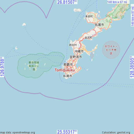
Tomigusuku GPS coordinates[2]
26° 11' 8.988" North, 127° 40' 54.912" East
| Map corner | latitude | longitude |
|---|---|---|
| Upper-left | 26.81507°, | 126.9788° |
| Center: | 26.18583°, | 127.68192° |
| Lower-right: | 25.55317°, | 128.38505° |
| Map W x H: | 140.3×140.3 km | = 87.2×87.2mi |
| max Lat: | 45.40944° ⇑99.4% North |
| Tomigusuku: | 26.18583° |
| min Lat: | ⇓0.6% South 24.34478° |
| min Long | Tomigusuku | max Long |
| 123° | 127.68192° | 145.575° |
| W 0.5%⇐ | ⇒99.5% E |
Elevation
Elevation of Tomigusuku is 47 m = 154 ft, and this is 37.6 m = 123 ft below average elevation for this country.
| Max E: |
1086 m = 3563 ft | 39.2% |
| Avg. | 84.6 m = 278 ft | |
| Tomigusuku | 47 m = 154 ft | |
Min E: |
-2 m = -7 ft | 60.8% |
See also: Tomigusuku elevation on elevation.city.
Geographical zone
Tomigusuku is located in North temperate zone (between Tropic of Cancer and the Arctic Circle). Distance of this Northern Tropic circle is 305.7 km =190 mi to South.| Distance of | km | miles | from Tomigusuku |
|---|---|---|---|
| North Pole | 7095.5 | 4408.9 | to North |
| Arctic Circle | 4489.6 | 2789.7 | to North |
| Tropic Cancer | 305.7 | 190 | to South |
| Equator | 2911.6 | 1809.2 | to South |


Nearby cities:
15 places around Tomigusuku: (largest is in red/bold)
• Chatan
16.3 km =10.1 mi,  32°
32°
• Ginowan
11.7 km =7.3 mi,  42°
42°
• Gushikawa
26.7 km =16.6 mi, 43°
• Hirara
284 km =176.5 mi,  237°
237°
• Ishikawa
29.8 km =18.5 mi, 27°
• Itoman
6.7 km =4.2 mi,  190°
190°
• Katsuren-haebaru
25.2 km =15.7 mi,  49°
49°
• Miyakojima
284.1 km =176.5 mi, 236°
• Nago
56.5 km =35.1 mi, 32°
• Naha
3.4 km =2.1 mi,  2°
2°
• Nanjō
9.7 km =6 mi,  118°
118°
• Naze
300.8 km =186.9 mi, 36°
• Okinawa
20.5 km =12.7 mi, 35°
• Urasoe
9.5 km =5.9 mi, 30°
• Uruma
27.6 km =17.1 mi, 39°
Sources, notices
• [Note1] Compared only with cities in Japan existing in our database
• [Src1] Map data: © OpenStreetMap contributors (CC-BY-SA)
• [Src2] Other city data from geonames.org with taken over terms of usage.
• [Src3] Geographical zone / Annual Mean Temperature by Robert A. Rohde @ Wikipedia
