Uruma geodata
Uruma (Okinawa) is a seat of a second-order administrative division; located in Japan in Asia/Tokyo (GMT+9) time zone. In our database, there are 767 cities with bigger population. Compared to other cities in Japan, 98.7% of cities are located further ↑North; 98.8% of cities are located further →East and 56.6% of cities have higher elevation than Uruma. Note1


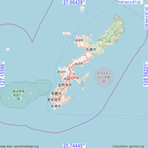
Uruma GPS coordinates[2]
26° 22' 33.924" North, 127° 51' 32.688" East
| Map corner | latitude | longitude |
|---|---|---|
| Upper-left | 27.00429°, | 127.15596° |
| Center: | 26.37609°, | 127.85908° |
| Lower-right: | 25.74445°, | 128.56221° |
| Map W x H: | 140.1×140.1 km | = 87.1×87.1mi |
| max Lat: | 45.40944° ⇑98.7% North |
| Uruma: | 26.37609° |
| min Lat: | ⇓1.3% South 24.34478° |
| min Long | Uruma | max Long |
| 123° | 127.85908° | 145.575° |
| W 1.2%⇐ | ⇒98.8% E |
Elevation
Elevation of Uruma is 22 m = 72 ft, and this is 62.6 m = 205 ft below average elevation for this country.
| Max E: |
1086 m = 3563 ft | 56.6% |
| Avg. | 84.6 m = 278 ft | |
| Uruma | 22 m = 72 ft | |
Min E: |
-2 m = -7 ft | 43.4% |
See also: Japan elevation on elevation.city.
Geographical zone
Uruma is located in North temperate zone (between Tropic of Cancer and the Arctic Circle). Distance of this Northern Tropic circle is 326.8 km =203.1 mi to South.| Distance of | km | miles | from Uruma |
|---|---|---|---|
| North Pole | 7074.3 | 4395.8 | to North |
| Arctic Circle | 4468.4 | 2776.5 | to North |
| Tropic Cancer | 326.8 | 203.1 | to South |
| Equator | 2932.7 | 1822.3 | to South |


Nearby cities:
15 places around Uruma: (largest is in red/bold)
• Amami
274.8 km =170.8 mi,  35°
35°
• Chatan
11.5 km =7.1 mi,  230°
230°
• Ginowan
15.9 km =9.9 mi,  217°
217°
• Gushikawa
2 km =1.2 mi,  156°
156°
• Hirara
310.3 km =192.8 mi,  235°
235°
• Ishikawa
6.5 km =4 mi,  324°
324°
• Itoman
33.6 km =20.9 mi,  214°
214°
• Katsuren-haebaru
5 km =3.1 mi, 162°
• Nago
29.4 km =18.3 mi,  25°
25°
• Naha
24.9 km =15.5 mi, 224°
• Nanjō
27.3 km =17 mi,  199°
199°
• Naze
273.3 km =169.8 mi, 35°
• Okinawa
7.3 km =4.5 mi, 232°
• Tomigusuku
27.6 km =17.1 mi, 219°
• Urasoe
18.3 km =11.4 mi, 224°
Sources, notices
• [Note1] Compared only with cities in Japan existing in our database
• [Src1] Map data: © OpenStreetMap contributors (CC-BY-SA)
• [Src2] Other city data from geonames.org with taken over terms of usage.
• [Src3] Geographical zone / Annual Mean Temperature by Robert A. Rohde @ Wikipedia
